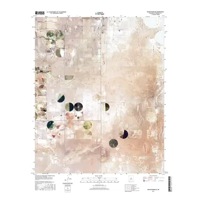
2017 Map of Mountainair NE
USGS Topo · Published 2017About this map
Estancia Spring and the surrounding high plains of Torrance County define this 2017 survey, where a strict grid of county roads overlays a landscape shaped by intermittent watercourses. The local topography is marked by significant features like Torreon Draw in the northwest and Arroyo de Manzano winding through the southern sections. This area, located just northeast of the town center, is historically anchored by the Estancia Cem, which serves as a primary point of reference for genealogists and local historians tracing family roots in this part of New Mexico. The map illustrates a transition from the structured township and range system, seen in the boundaries of t6n r8e and t5n r9e, to the more organic flow of the natural drainage basins. Roads such as Spangler Rd and Green Hawk Rd provide the modern framework for this rural landscape, connecting isolated homesteads and grazing lands.
Find a feature on this map
30 named features on this map. Tap any name to fly to it.
Don’t see what you’re looking for? This feature index may not catch every label — zoom into the map to look around manually.
Map Details
Editions of this 2017 Mountainair NE Map
This is the sole edition of this map. No revisions or reprints were ever made.
Other maps of this area

1917 · Estancia
USGS Topo · 1:125,000

1954 · Milbourn Ranch
USGS Topo · 1:24,000

1954 · Fort Sumner
USGS Topo · 1:250,000

1954 · Socorro
USGS Topo · 1:250,000

1956 · Estancia
USGS Topo · 1:62,500

1956 · Mountainair
USGS Topo · 1:62,500

1958 · Socorro
USGS Topo · 1:250,000

1958 · Fort Sumner
USGS Topo · 1:250,000

1960 · Lobo Hill
USGS Topo · 1:62,500

1962 · Socorro
USGS Topo · 1:250,000