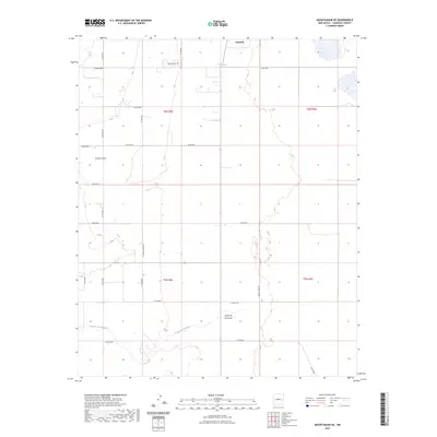
2023 Map of Mountainair NE
USGS Topo · Published 2023About this map
Estancia and the surrounding high plains of Torrance County define this 2023 survey of central New Mexico. The landscape is characterized by its drainage patterns and historical rural infrastructure, featuring the notable Estancita Spring and the winding Torreon Draw in the northern reaches. The presence of the Estancia Cem serves as a significant marker for local genealogical research, anchoring the town's history within the broader grid of Torrance County's rural road system. In the southern portion of the quadrangle, the Arroyo de Manzano cuts across the terrain, reflecting the seasonal water movements essential to this arid region. The map documents a complex network of local routes, including the precisely named La Trencaeriera Rd and Green Hawk Rd, which provide access to the vast ranching and agricultural tracts that have long sustained the local economy.
Find a feature on this map
31 named features on this map. Tap any name to fly to it.
Don’t see what you’re looking for? This feature index may not catch every label — zoom into the map to look around manually.
Map Details
Editions of this 2023 Mountainair NE Map
This is the sole edition of this map. No revisions or reprints were ever made.
Other maps of this area

1917 · Estancia
USGS Topo · 1:125,000

1954 · Milbourn Ranch
USGS Topo · 1:24,000

1954 · Fort Sumner
USGS Topo · 1:250,000

1954 · Socorro
USGS Topo · 1:250,000

1956 · Estancia
USGS Topo · 1:62,500

1956 · Mountainair
USGS Topo · 1:62,500

1958 · Socorro
USGS Topo · 1:250,000

1958 · Fort Sumner
USGS Topo · 1:250,000

1960 · Lobo Hill
USGS Topo · 1:62,500

1962 · Socorro
USGS Topo · 1:250,000