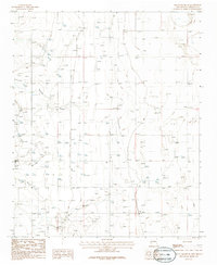
1986 Map of Mountainair NE
USGS Topo · Published 1986About this map
Torreon Draw and Arroyo de Manzano dominate this arid central New Mexico landscape, illustrating the ephemeral drainage patterns characteristic of the Estancia Basin. The map captures a moment in the mid-1980s when transportation and utility infrastructure carved straight lines across the basin floor, including a prominent Old R.R. Grade and a north-south Pipeline. For local historians, the location of a small Cem. and multiple Gravel Pits provide clues to early land use and settlement proximity. To the northeast, the expanse of a large Salt Flat marks the hydrologic low point of the region, where numerous scattered wells suggest the ongoing search for water in this high-desert environment.
Find a feature on this map
10 named features on this map. Tap any name to fly to it.
Don’t see what you’re looking for? This feature index may not catch every label — zoom into the map to look around manually.
Map Details
Editions of this 1986 Mountainair NE Map
This is the sole edition of this map. No revisions or reprints were ever made.
Other maps of this area

1917 · Estancia
USGS Topo · 1:125,000

1954 · Milbourn Ranch
USGS Topo · 1:24,000

1954 · Fort Sumner
USGS Topo · 1:250,000

1954 · Socorro
USGS Topo · 1:250,000

1956 · Estancia
USGS Topo · 1:62,500

1956 · Mountainair
USGS Topo · 1:62,500

1958 · Socorro
USGS Topo · 1:250,000

1958 · Fort Sumner
USGS Topo · 1:250,000

1960 · Lobo Hill
USGS Topo · 1:62,500

1962 · Socorro
USGS Topo · 1:250,000