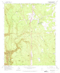
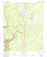
1962 Map of Mountainaire
USGS Topo · Published 1975About this map
Mountainaire sits at the heart of this high-country landscape, where the Flagstaff Corporate Boundary meets the dense timber of the Coconino National Forest. The map documents a transition between early mid-century recreational infrastructure and specialized industry, evidenced by the presence of Lindbergh Spring Roadside Park alongside the winding route of the Industrial Railroad. The terrain is defined by deep cuts like Kelly Canyon and James Canyon, which funnel seasonal drainage into numerous tanks and seeps.
Find a feature on this map
63 named features on this map. Tap any name to fly to it.
Don’t see what you’re looking for? This feature index may not catch every label — zoom into the map to look around manually.
Map Details
Editions of this 1962 Mountainaire Map
5 editions found
Other maps of this area

1886 · San Francisco Mtns
USGS Topo · 1:250,000

1887 · Verde
USGS Topo · 1:250,000

1891 · San Francisco Mtns
USGS Topo · 1:250,000

1892 · Verde
USGS Topo · 1:250,000

1894 · San Francisco Mtns
USGS Topo · 1:250,000

1899 · San Francisco Mtns
USGS Topo · 1:250,000

1908 · Flagstaff
USGS Topo · 1:125,000

1912 · Flagstaff
USGS Topo · 1:125,000

1923 · Camp Verde
USGS Topo · 1:125,000

1932 · Camp Verde
USGS Topo · 1:125,000