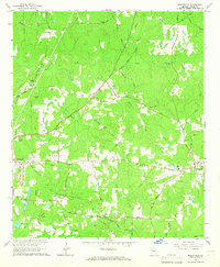
1964 Map of Mountville
USGS Topo · Published 1965About this map
The community of Mountville serves as a primary hub in this mid-century portrait of Troup County, where the convergence of the Atlantic Coast Line Railroad and local thoroughfares like Hogansville Road shaped the regional movement of goods and people. The landscape is deeply etched with family and community history, evidenced by a dense network of country sanctuaries such as Union Chapel and St Bethel Ch, alongside numerous family burial grounds including the Traylor-Johnson Cem and Reid Cem.
Find a feature on this map
62 named features on this map. Tap any name to fly to it.
Don’t see what you’re looking for? This feature index may not catch every label — zoom into the map to look around manually.
Map Details
Editions of this 1964 Mountville Map
3 editions found
Other maps of this area

1899 · Wedowee
USGS Topo · 1:125,000

1902 · Wedowee
USGS Topo · 1:125,000

1907 · Talbotton
USGS Topo · 1:125,000

1907 · Opelika
USGS Topo · 1:125,000

1909 · Opelika
USGS Topo · 1:125,000

1953 · Atlanta
USGS Topo · 1:250,000

1955 · Phenix City
USGS Topo · 1:250,000

1957 · Phenix City
USGS Topo · 1:250,000

1957 · Atlanta
USGS Topo · 1:250,000

1958 · Phenix City
USGS Topo · 1:250,000