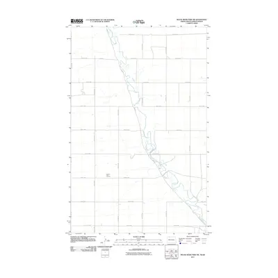
2011 Map of Mouse River Park NW
USGS Topo · Published 2011About this map
The Souris River meanders sharply through this rural landscape in Renville County, creating a complex series of oxbows and bends that dominate the topography. The river valley is flanked by a grid of agricultural roads, including River Rd and County Rd 2, which partition the prairie into vast sections. Amidst these fields lies the Pleasant View Cemetery, a significant landmark for those researching local family histories in this corner of North Dakota. The proximity of the cemetery to the winding river suggests an early focus for local burial on higher ground overlooking the valley. This 2011 survey by the U.S. Geological Survey provides a precise look at the drainage patterns and rural infrastructure before further modern development, capturing the essential character of the northern Great Plains.
Find a feature on this map
18 named features on this map. Tap any name to fly to it.
Don’t see what you’re looking for? This feature index may not catch every label — zoom into the map to look around manually.
Map Details
Editions of this 2011 Mouse River Park NW Map
This is the sole edition of this map. No revisions or reprints were ever made.
Other maps of this area

1948 · Mouse River Park NW
USGS Topo · 1:24,000

1949 · Mouse River Park NW
USGS Topo · 1:24,000

1949 · Bowbells SE
USGS Topo · 1:24,000

1949 · Bowbells NE
USGS Topo · 1:24,000

1949 · Mouse River Park NE
USGS Topo · 1:24,000

1949 · Mouse River Park SW
USGS Topo · 1:24,000

1949 · Mouse River Park
USGS Topo · 1:24,000

1950 · Bowbells
USGS Topo · 1:62,500
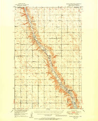
1950 · Mouse River Park
USGS Topo · 1:62,500

1953 · Williston
USGS Topo · 1:250,000