
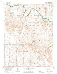
1963 Map of Mouth of Wild Horse Creek
USGS Topo · Published 1993About this map
The Saline River winds through the northern reaches of this Kansas landscape, joined by its namesake tributary at the Mouth of Wild Horse Creek. This 1963 field-checked survey reveals a rural landscape defined by both early educational foundations and the expanding energy industry of the mid-20th century. Local history is anchored by the Cottonwood Grove Sch and St John Ch, while the terrain further south is marked by an extensive Oil Field and numerous Oil Wells. The geological character of the region is further evidenced by a Gravel Pit and Shale Pit located near the southern fork of Spring Creek. Spanning the boundary of Trego and Ellis Counties, the map illustrates a transition from river-bottom ranching to upland resource extraction.
Find a feature on this map
16 named features on this map. Tap any name to fly to it.
Don’t see what you’re looking for? This feature index may not catch every label — zoom into the map to look around manually.
Map Details
Editions of this 1963 Mouth of Wild Horse Creek Map
2 editions found
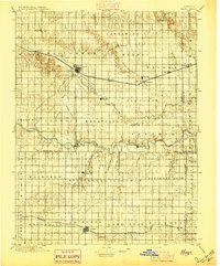
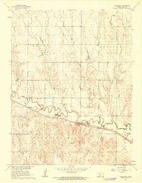
Other maps of this area

1893 · Ellis
USGS Topo · 1:125,000

1893 · Hill
USGS Topo · 1:125,000
1896 · Hays
USGS Topo · 1:125,000

1896 · Plainville
USGS Topo · 1:125,000

1955 · Great Bend
USGS Topo · 1:250,000

1955 · Beloit
USGS Topo · 1:250,000

1957 · Great Bend
USGS Topo · 1:250,000

1958 · Great Bend
USGS Topo · 1:250,000

1959 · Beloit
USGS Topo · 1:250,000
1961 · Yocemento
USGS Topo · 1:24,000