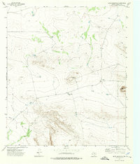
1973 Map of Movie Mountain
USGS Topo · Published 1976About this map
Movie Mountain and Sneed Mountain dominate this arid Hudspeth County landscape, providing topographic relief above the expansive Blanca Flats. This early-1970s survey captures a West Texas terrain defined by ranching infrastructure and mineral exploration. Significant water features such as Horse Trap Tank, Two Section Tank, and Corner Tank highlight the necessity of managed water sources in this high-desert environment. Evidence of human activity is scattered across the sheet, from a remote Drill Hole near the base of the peaks to a Gravel Pit along the eastern slopes. A network of unimproved tracks and a Jeep Trail trace the contours of the flats, indicating a region where access was limited to specialized vehicles and ranching operations.
Find a feature on this map
9 named features on this map. Tap any name to fly to it.
Don’t see what you’re looking for? This feature index may not catch every label — zoom into the map to look around manually.
Map Details
Editions of this 1973 Movie Mountain Map
This is the sole edition of this map. No revisions or reprints were ever made.
Other maps of this area

1895 · Sierra Blanca
USGS Topo · 1:125,000

1948 · Triple Hill
USGS Topo · 1:62,500

1954 · Van Horn
USGS Topo · 1:250,000

1958 · Van Horn
USGS Topo · 1:250,000

1964 · Dome Peak
USGS Topo · 1:24,000
1964 · Bean Hills
USGS Topo · 1:24,000
1964 · Sierra Blanca
USGS Topo · 1:24,000

1973 · Norton Mesa
USGS Topo · 1:24,000

1973 · Sneed Mountain NE
USGS Topo · 1:24,000
1973 · Sneed Mountain
USGS Topo · 1:24,000