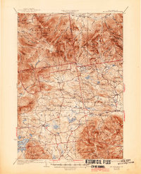
1931 Map of Mt. Chocorua
USGS Topo · Published 1945About this map
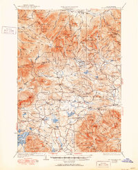
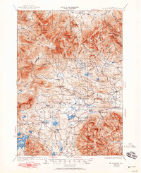
White Mountain National Forest dominates the northern half of this landscape, where a dense network of hiking routes such as the Champney Falls Trail and Liberty Trail connect high-elevation landmarks. The transition from the high peaks of the Ossipee Mountains to the valley floor reveals a 1920s rural economy centered on the Bearcamp River and Swift River. The southern portion of the map is punctuated by small community centers like Center Sandwich and Tamworth, where local life was anchored by institutions such as the Friends Ch and various district schools including Whiteface Sch and Fellows Sch.
Find a feature on this map
175 named features on this map. Tap any name to fly to it.
Don’t see what you’re looking for? This feature index may not catch every label — zoom into the map to look around manually.
Map Details
Editions of this 1931 Mt. Chocorua Map
7 editions found

Other maps of this area

1894 · North Conway
USGS Topo · 1:62,500

1895 · Crawford Notch
USGS Topo · 1:62,500

1896 · Crawford Notch
USGS Topo · 1:62,500

1896 · North Conway
USGS Topo · 1:62,500

1909 · Winnepesaukee
USGS Topo · 1:62,500

1925 · Holderness
USGS Topo · 1:62,500

1927 · Holderness
USGS Topo · 1:62,500

1928 · Wolfeboro
USGS Topo · 1:62,500

1928 · Plymouth
USGS Topo · 1:62,500

1929 · Franconia
USGS Topo · 1:62,500