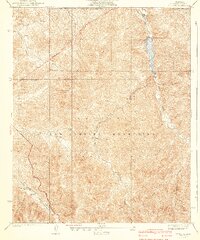
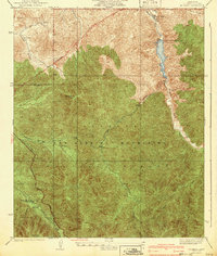
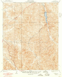
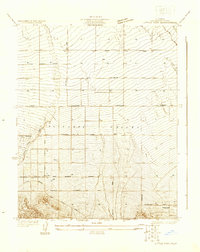
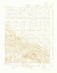
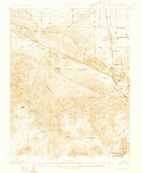
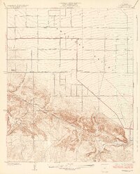
1940 Map of Mt. Emma
USGS Topo · Published 1940About this map
San Gabriel Mountains topography defines this portion of the Angeles National Forest, where high peaks and deep canyons dictated the early routes of travel and settlement. Surveyed in the mid-1930s, the map documents the Little Rock Palmdale Dam holding back the waters of Little Rock Creek in the northeast. The presence of a CCC Camp near the reservoir reflects the era's public works projects within the forest. Travel through this vertical landscape is traced by the Angeles Forest Highway and a prominent Transmission Line, while localized landmarks like the Wagonwheel Ranch and Kentucky Springs Canyon indicate pockets of habitation and water resources. The terrain transitions from the heights of Mt Emma down through complex drainage systems like Santiago Canyon and Aliso Canyon, providing a detailed look at the wilderness character of Los Angeles County before late-century development.
Find a feature on this map
23 named features on this map. Tap any name to fly to it.
Don’t see what you’re looking for? This feature index may not catch every label — zoom into the map to look around manually.
Map Details
Editions of this 1940 Mt. Emma Map
3 editions found
Other maps of this area

1900 · Tujunga
USGS Topo · 1:62,500

1901 · Southern California Sheet No. 1
USGS Topo · 1:250,000

1903 · Rock Creek
USGS Topo · 1:62,500

1904 · Southern California Sheet No. 1
USGS Topo · 1:250,000

1915 · Elizabeth Lake
USGS Topo · 1:125,000

1917 · Elizabeth Lake
USGS Topo · 1:125,000
1930 · Little Rock
USGS Topo · 1:24,000
1930 · Pearland
USGS Topo · 1:24,000
1932 · Palmdale
USGS Topo · 1:24,000
1934 · Pearland
USGS Topo · 1:24,000