
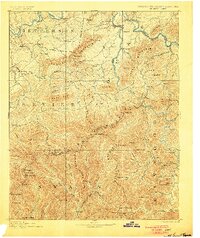
1893 Map of Mt Guyot
USGS Topo · Published 1893About this map
English Mountain and the high peaks of the Great Smoky Mountains dominate this late nineteenth-century topographic study of the Tennessee and North Carolina border. The landscape is defined by the sharp transition from the valley floor of the French Broad River to the massive ridges of Stone Mountain and Webb Mtn. Settlement is concentrated in the northern valleys, where established communities like Fair Garden and Chestnut Hill sit along a network of wagon roads, including the prominent Elliot Ferry Road. Along the northern edge, the Virginia and Georgia Railroad follows the river bend through Newport and Delrio, marking the primary transportation artery for the region's timber and agricultural trade. In the southern half of the map, the terrain becomes increasingly complex as the Pigeon River carves through deep gaps near Waterville, illustrating the geographic isolation of the high-elevation settlements like Jones Cove and Cosby during this era.
Find a feature on this map
118 named features on this map. Tap any name to fly to it.
Don’t see what you’re looking for? This feature index may not catch every label — zoom into the map to look around manually.
Map Details
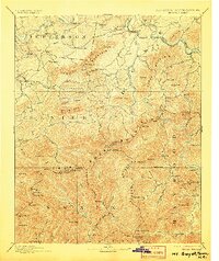
Editions of this 1893 Mt Guyot Map
3 editions found
Other maps of this area

1883 · Morristown
USGS Topo · 1:125,000

1886 · Knoxville
USGS Topo · 1:125,000

1891 · Cowee
USGS Topo · 1:125,000

1892 · Greeneville
USGS Topo · 1:125,000

1892 · Knoxville
USGS Topo · 1:125,000

1893 · Morristown
USGS Topo · 1:125,000

1894 · Asheville
USGS Topo · 1:125,000

1894 · Knoxville
USGS Topo · 1:125,000

1895 · Morristown
USGS Topo · 1:125,000

1895 · Knoxville
USGS Topo · 1:125,000