
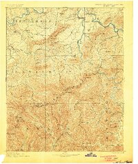
1893 Map of Mt Guyot
USGS Topo · Published 1893This historical map portrays the area of Mt Guyot in 1893, primarily covering Cocke County as well as portions of North Carolina. Featuring a scale of 1:125000, this map provides a highly detailed snapshot of the terrain, roads, buildings, counties, and historical landmarks in the Mt Guyot region at the time. Published in 1893, it is one of 3 known editions of this map due to revisions or reprints.
Find a feature on this map
118 named features on this map. Tap any name to fly to it.
Don’t see what you’re looking for? This feature index may not catch every label — zoom into the map to look around manually.
Map Details
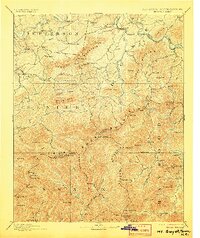
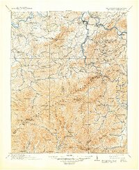
Editions of this 1893 Mt Guyot Map
3 editions found
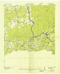
Historical Maps of East Fork Through Time
11 maps found
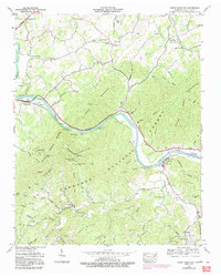
1893 Mt Guyot
Cocke County, TN
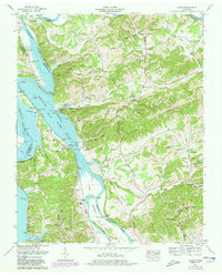
1912 Mt. Guyot
Cocke County, TN
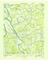
1935 Hartford
Cocke County, TN
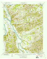
1935 Neddy Mountain
Cocke County, TN
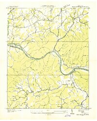
1935 Rankin
Cocke County, TN

1935 Small
Cocke County, TN
1939 Rankin
Cocke County, TN
1940 Hartford
Cocke County, TN
1940 Neddy Mountain
Cocke County, TN
1961 Rankin
Cocke County, TN
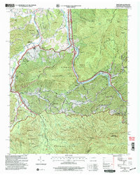
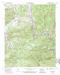
2003 Hartford
Cocke County, TN