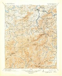
1912 Map of Mt. Guyot
USGS Topo · Published 1948About this map
The Qualla Indian Reservation and the high ridges of the Great Smoky Mountains define this landscape during the early twentieth century. This survey, conducted primarily between 1883 and 1891 with later revisions, shows the region before the creation of the national park, when settlements like Smokemont and Richardson Cove were active mountain communities. In the north, the French Broad River serves as a corridor for the Southern Railway, connecting Newport and Bridgeport to the wider rail network. High peaks including Mt Le Conte, Mt Guyot, and Clingmans Dome mark the border between Tennessee and North Carolina. The map captures an era of transitions, showing established timber and rail sites such as Naillon Sta and Crestmont alongside traditional mountain gaps and balds like Indian Gap and Andrews Bald.
Find a feature on this map
138 named features on this map. Tap any name to fly to it.
Don’t see what you’re looking for? This feature index may not catch every label — zoom into the map to look around manually.
Map Details
Editions of this 1912 Mt. Guyot Map
5 editions found

Other maps of this area

1883 · Morristown
USGS Topo · 1:125,000

1886 · Knoxville
USGS Topo · 1:125,000

1891 · Cowee
USGS Topo · 1:125,000

1892 · Greeneville
USGS Topo · 1:125,000

1892 · Knoxville
USGS Topo · 1:125,000

1893 · Mt Guyot
USGS Topo · 1:125,000

1893 · Morristown
USGS Topo · 1:125,000

1894 · Asheville
USGS Topo · 1:125,000

1894 · Knoxville
USGS Topo · 1:125,000

1895 · Morristown
USGS Topo · 1:125,000