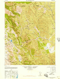
1947 Map of Mt. Hamilton
USGS Topo · Published 1947About this map
The Lick Observatory stands as the central landmark atop Mt Hamilton, reached by a winding road that climbs through the steep ridges of the Diablo Range. This 1947 edition, based on earlier Army Map Service work and 1938 aerial photography, details a landscape dominated by extensive private landholdings and rugged ranching terrain. The settlement pattern is defined by family-named estates such as Evergreen Ranch, Hendricks Ranch, and the Fisher Homestead, reflecting the area's agricultural heritage before modern expansion. Educational and civic life in these mountain valleys is represented by the Halls Valley Sch and the Smith Creek Ranger Sta. Significant relief features like Copernicus Pk and Eylar Mountain rise above deep drainages including Arroyo Hondo and Arroyo Valle, while the boundary between Alameda and Santa Clara Counties follows the high crests of the Burnt Hills and Mason Ridge.
Find a feature on this map
72 named features on this map. Tap any name to fly to it.
Don’t see what you’re looking for? This feature index may not catch every label — zoom into the map to look around manually.
Map Details
Editions of this 1947 Mt. Hamilton Map
This is the sole edition of this map. No revisions or reprints were ever made.
Other maps of this area

1889 · San Jose
USGS Topo · 1:62,500

1897 · San Jose
USGS Topo · 1:62,500

1897 · Mt. Hamilton
USGS Topo · 1:62,500

1899 · San Jose
USGS Topo · 1:62,500

1906 · Pleasanton
USGS Topo · 1:62,500

1907 · Tesla
USGS Topo · 1:62,500

1916 · New Almaden
USGS Topo · 1:48,000

1917 · Morgan Hill
USGS Topo · 1:62,500

1919 · New Almaden
USGS Topo · 1:62,500

1921 · Gilroy Hot Springs
USGS Topo · 1:62,500