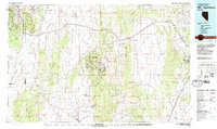
1979 Map of Mt. Hamilton
USGS Topo · Published 1979About this map
The White Pine Range serves as the geographic anchor for this 1979 survey, which details a landscape defined by Nevada's historic mining activity. Near the center of the sheet, the old mining hub of Hamilton is surrounded by high-altitude operations such as Treasure Hill and the Belmont Mill. These sites, along with the Eberhardt Mine and Seligman Mine, represent the region's late 19th-century silver boom and subsequent industrial shifts. The isolation of these mountain camps is underscored by the expansive Newark Valley and Jakes Valley flanking the central ranges.
Find a feature on this map
34 named features on this map. Tap any name to fly to it.
Don’t see what you’re looking for? This feature index may not catch every label — zoom into the map to look around manually.
Map Details
Editions of this 1979 Mt. Hamilton Map
2 editions found

Other maps of this area

1926 · Roberts Mountains
USGS Topo · 1:250,000

1929 · Roberts Mountains
USGS Topo · 1:250,000

1949 · Treasure Hill
USGS Topo · 1:62,500

1950 · Treasure Hill
USGS Topo · 1:62,500

1951 · Green Springs
USGS Topo · 1:62,500

1951 · Illipah
USGS Topo · 1:62,500

1951 · Pancake Summit
USGS Topo · 1:62,500

1952 · Ely
USGS Topo · 1:125,000

1953 · Pinto Summit
USGS Topo · 1:62,500

1953 · Eureka
USGS Topo · 1:62,500