
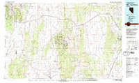
1979 Map of Mt. Hamilton
USGS Topo · Published 1979About this map
White Pine Mountains and the surrounding high-altitude basins dominate this 1970s landscape, revealing the complex mining and ranching history of eastern Nevada. The area around Hamilton serves as a focal point for historic silver mining activity, with numerous named operations including Treasure Hill Mine, Eberhardt Mine, and Jenny A Mine clustered along Pogonip Ridge. These sites are linked to the processing ruins at Belmont Mill, illustrating the industrial scale of the White Pine mining district.
Find a feature on this map
46 named features on this map. Tap any name to fly to it.
Don’t see what you’re looking for? This feature index may not catch every label — zoom into the map to look around manually.
Map Details
Editions of this 1979 Mt. Hamilton Map
2 editions found
Other maps of this area

1926 · Roberts Mountains
USGS Topo · 1:250,000

1929 · Roberts Mountains
USGS Topo · 1:250,000

1949 · Treasure Hill
USGS Topo · 1:62,500

1950 · Treasure Hill
USGS Topo · 1:62,500

1951 · Green Springs
USGS Topo · 1:62,500

1951 · Illipah
USGS Topo · 1:62,500

1951 · Pancake Summit
USGS Topo · 1:62,500

1952 · Ely
USGS Topo · 1:125,000

1953 · Pinto Summit
USGS Topo · 1:62,500

1953 · Eureka
USGS Topo · 1:62,500