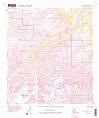
1955 Map of Mt. Hayes C-3
USGS Topo · Published 1975About this map
Mount Hajdukovich anchors the southern portion of this high-altitude landscape, where the massive Gerstle Glacier descends toward the lowlands. The ice field is marked by numerous Crevasses, indicating a dynamic glacial environment during the mid-1950s. As the ice melts, it feeds the wide, braided channel of the Gerstle River, which dominates the central valley. North of the river, Granite Mountain rises sharply, its slopes drained by several named streams including Granite Creek and McCumber Creek. This 1955 survey captures a roadless wilderness in the Alaska Range, where the only passage through the high peaks is marked by points like St Anthony Pass. The map serves as a primary record of glacial extent and alpine drainage patterns, including smaller tributaries like Little Gerstle River and Pegmatite Creek, before modern climatic shifts significantly altered these northern ice sheets.
Find a feature on this map
14 named features on this map. Tap any name to fly to it.
Don’t see what you’re looking for? This feature index may not catch every label — zoom into the map to look around manually.
Map Details
Editions of this 1955 Mt. Hayes C-3 Map
3 editions found

Other maps of this area

1950 · Mount Hayes
USGS Topo · 1:250,000

1950 · Mount Hayes D-4
USGS Topo · 1:63,360

1950 · Mount Hayes C-4
USGS Topo · 1:63,360

1951 · Mount Hayes
USGS Topo · 1:250,000

1952 · Mount Hayes D-4
USGS Topo · 1:63,360

1952 · Mount Hayes C-4
USGS Topo · 1:63,360

1952 · Mount Hayes B-4
USGS Topo · 1:63,360

1954 · Mount Hayes C-3
USGS Topo · 1:63,360

1954 · Mount Hayes D-2
USGS Topo · 1:63,360

1954 · Mount Hayes D-3
USGS Topo · 1:63,360