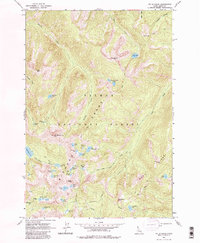
1962 Map of Mt Mc Guire
USGS Topo · Published 1984About this map
Mt McGuire towers over a complex landscape of the Salmon River Mountains, where the 1962 field check recorded a dense concentration of high-elevation water bodies and granite formations. This area of the Bighorn Crags is defined by its glacial morphology, featuring numerous cirque lakes such as Ship Island Lake, Airplane Lake, and Barking Fox Lake. The terrain is characterized by sharp ridgelines including Fishfin Ridge and Gant Ridge, which separate the various drainages of Roaring Creek and Clear Creek. The map reveals a network of primitive paths designated simply as Trail, providing the only access through the Crags during the early 1960s. Notable landmarks like the Beehive and Cathedral Rock serve as distinct navigational points within the Salmon River Mountains, illustrating the geologic character of the Idaho and Lemhi County border region.
Find a feature on this map
47 named features on this map. Tap any name to fly to it.
Don’t see what you’re looking for? This feature index may not catch every label — zoom into the map to look around manually.
Map Details
Editions of this 1962 Mt Mc Guire Map
3 editions found
Other maps of this area

1950 · Blackbird Mtn
USGS Topo · 1:62,500

1951 · Blackbird Mtn
USGS Topo · 1:62,500

1956 · Elk City
USGS Topo · 1:250,000

1960 · Elk City
USGS Topo · 1:250,000

1960 · Shoup
USGS Topo · 1:62,500

1962 · Hoodoo Meadows
USGS Topo · 1:24,000

1962 · Long Tom Mtn
USGS Topo · 1:24,000

1962 · Puddin Mtn
USGS Topo · 1:24,000

1962 · Aggipah Mtn
USGS Topo · 1:24,000

1962 · Mt Mc Guire
USGS Topo · 1:24,000