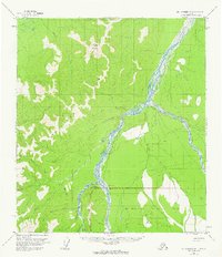
1954 Map of Mt. McKinley D-1
USGS Topo · Published 1963About this map
Mt McKinley National Park dominates the southern reaches of this mid-century survey, its northern boundary marked near the Toklat River. The landscape is defined by the high elevations of the Kantishna Hills, where watercourses like Moose Creek and Crooked Creek carve through the terrain. Evidence of wilderness activity is sparse but significant, including a Placer Mine and a lone Cabin situated along the riverbanks.
Find a feature on this map
25 named features on this map. Tap any name to fly to it.
Don’t see what you’re looking for? This feature index may not catch every label — zoom into the map to look around manually.
Map Details
Editions of this 1954 Mt. McKinley D-1 Map
2 editions found

Other maps of this area

1948 · Kantishna River
USGS Topo · 1:250,000

1950 · Fairbanks
USGS Topo · 1:250,000

1951 · Healy
USGS Topo · 1:250,000

1951 · Kantishna River
USGS Topo · 1:250,000

1951 · Fairbanks
USGS Topo · 1:250,000

1951 · Mount McKinley D-1
USGS Topo · 1:63,360

1951 · Healy D-6
USGS Topo · 1:63,360

1952 · Mount McKinley
USGS Topo · 1:250,000

1952 · Fairbanks A-6
USGS Topo · 1:63,360

1952 · Kantishna River A-1
USGS Topo · 1:63,360