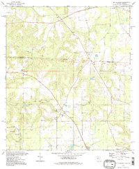
1994 Map of Mt Pleasant
USGS Topo · Published 1998About this map
The Watson Line and the Georgia-Florida state boundary divide this landscape of the Deep South, where the terrain is defined by the winding paths of North Mosquito Creek and South Mosquito Creek. A dense network of rural congregations anchors these communities, with spiritual and social life centering on Pleasant Hope Ch, Morning Star Ch, and St Mary Ch. The settlement of Mt Pleasant serves as a local hub near the center of the quadrangle, supported by a small Landing Strip and proximity to the Georgia border.
Find a feature on this map
28 named features on this map. Tap any name to fly to it.
Don’t see what you’re looking for? This feature index may not catch every label — zoom into the map to look around manually.
Map Details
Editions of this 1994 Mt Pleasant Map
This is the sole edition of this map. No revisions or reprints were ever made.
Other maps of this area

1954 · Tallahassee
USGS Topo · 1:250,000

1955 · Reynoldsville
USGS Topo · 1:24,000

1955 · Sycamore
USGS Topo · 1:24,000

1955 · Chattahoochee
USGS Topo · 1:24,000

1955 · Bainbridge
USGS Topo · 1:62,500

1955 · Mt Pleasant
USGS Topo · 1:24,000

1956 · Dogtown
USGS Topo · 1:24,000

1959 · Tallahassee
USGS Topo · 1:250,000

1959 · Gretna
USGS Topo · 1:24,000

1959 · Quincy
USGS Topo · 1:24,000