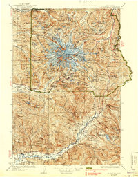
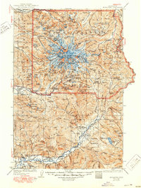
1928 Map of Mt Rainier
USGS Topo · Published 1939About this map
Mt Rainier dominates this mid-1920s survey, its glaciated summit featuring Columbia Crest, Liberty Cap, and Point Success. The surrounding Mount Rainier National Park landscape is defined by its early administrative infrastructure, including the Longmire (Superintendents Headquarters) and a network of outposts like the Carbon River Entrance Ranger Station and Garden Ranger Sta.
Find a feature on this map
132 named features on this map. Tap any name to fly to it.
Don’t see what you’re looking for? This feature index may not catch every label — zoom into the map to look around manually.
Map Details
Editions of this 1928 Mt Rainier Map
6 editions found

Other maps of this area

1897 · Tacoma
USGS Topo · 1:125,000

1900 · Tacoma
USGS Topo · 1:125,000

1901 · Snoqualmie Pass
USGS Topo · 1:125,000

1902 · Mount Aix
USGS Topo · 1:125,000

1903 · Snoqualmie
USGS Topo · 1:125,000

1904 · Mt Aix
USGS Topo · 1:125,000

1904 · Mount Adams
USGS Topo · 1:125,000

1907 · Mount Adams
USGS Topo · 1:125,000

1913 · Cedar Lake
USGS Topo · 1:125,000

1919 · Mount St Helens
USGS Topo · 1:125,000