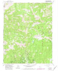
1968 Map of Mt. Rose
USGS Topo · Published 1983About this map
Incline Village sits at the base of the high Sierra Nevada, marking a period of rapid development along the north shore of Lake Tahoe. This survey, updated with revisions from 1980, captures the early infrastructure of the resort community, including Incline High Sch and a local Trailer Park. The terrain is dominated by the Toiyabe National Forest, where steep ridgelines connect prominent peaks such as Mt Rose and Slide Mountain.
Find a feature on this map
41 named features on this map. Tap any name to fly to it.
Don’t see what you’re looking for? This feature index may not catch every label — zoom into the map to look around manually.
Map Details
Editions of this 1968 Mt. Rose Map
2 editions found
Other maps of this area

1891 · Carson
USGS Topo · 1:125,000

1891 · Truckee
USGS Topo · 1:125,000

1893 · Carson
USGS Topo · 1:125,000

1893 · Truckee
USGS Topo · 1:125,000

1895 · Truckee
USGS Topo · 1:125,000

1932 · Truckee
USGS Topo · 1:96,000

1940 · Truckee
USGS Topo · 1:125,000

1950 · Mt. Rose
USGS Topo · 1:62,500

1952 · Mt. Rose
USGS Topo · 1:62,500
1955 · Kings Beach
USGS Topo · 1:24,000