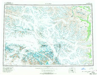
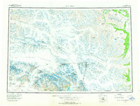
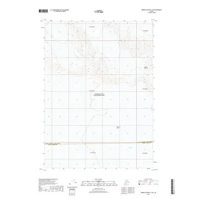
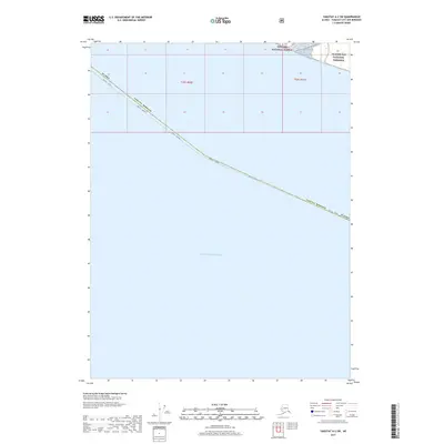
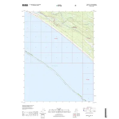
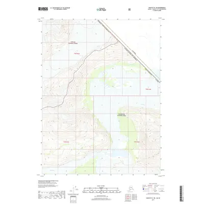
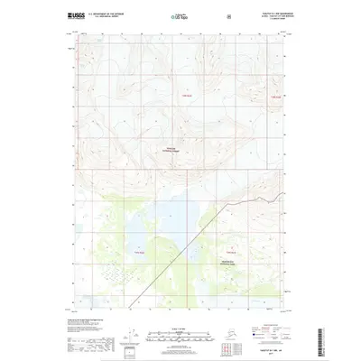
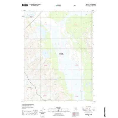
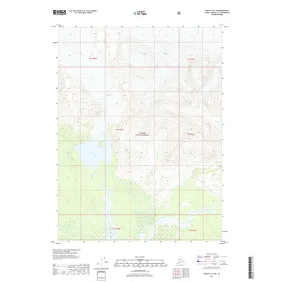
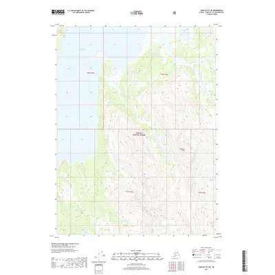
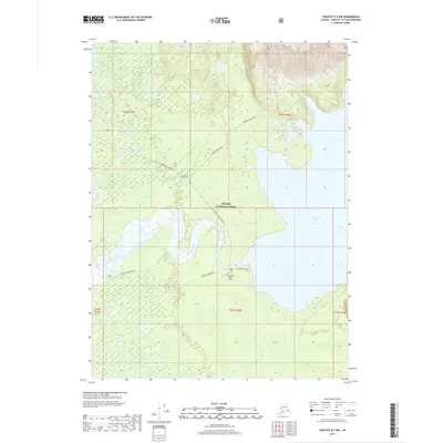
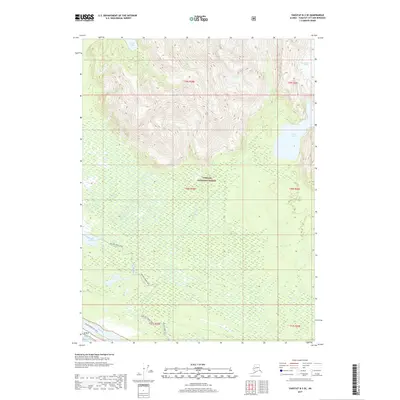
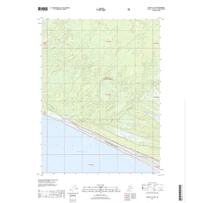
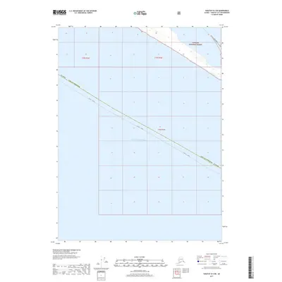
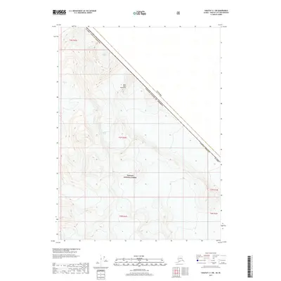
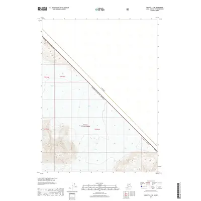
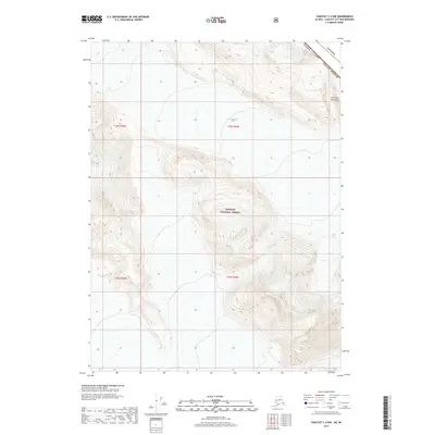
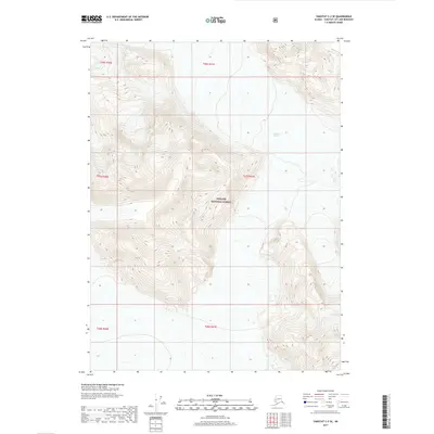
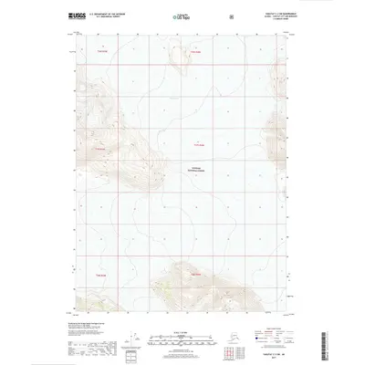
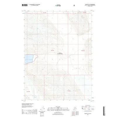
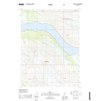
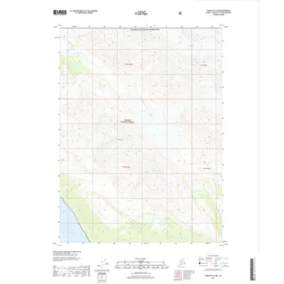
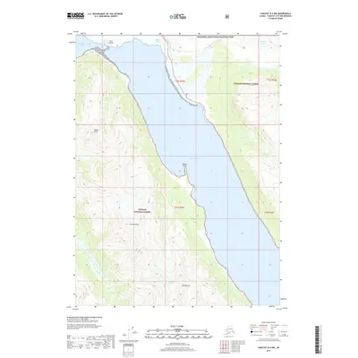
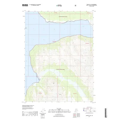
1959 Map of Mt Saint Elias
USGS Topo · Published 1970About this map
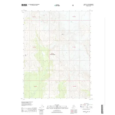
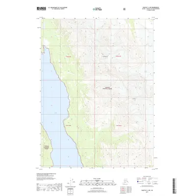
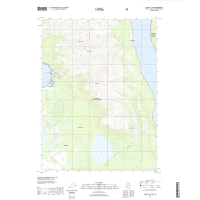
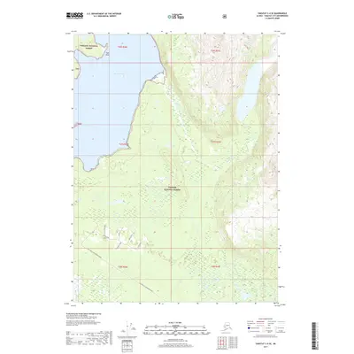
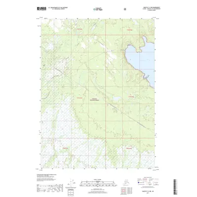
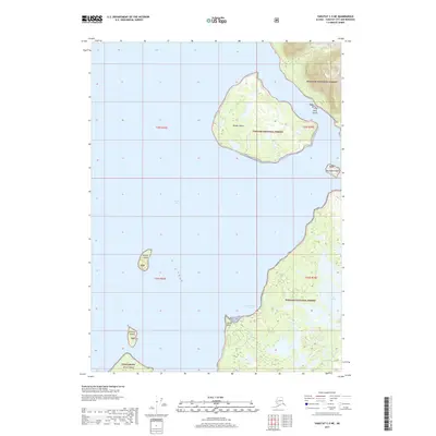
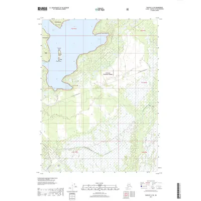
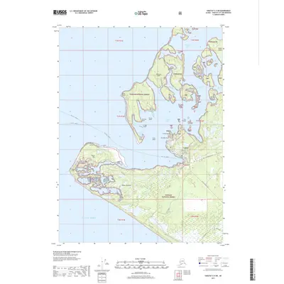
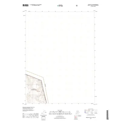
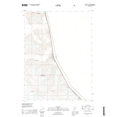
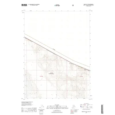
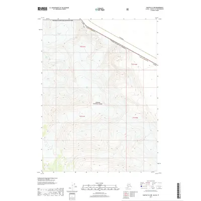
The St Elias Mountains dominate this 1959 survey, revealing a massive glacial system where the Hubbard Glacier and Valerie Glacier converge at the international boundary. This sheet documents the high-altitude landscape of the Icefield Ranges, tracing the transition from the frozen peaks of Mt St Elias and Mt Vancouver toward the northeastern edge where the Alaska Highway skirts the Kluane River valley. To the north, the map details the Kluane Lake region, showing the drainage of the Slims River and the rugged Kluane Hills. The intricate network of ice fields, including the Lowell Glacier and Kaskawulsh Glacier, illustrates the immense scale of the Saint Elias wilderness during the mid-20th century. This document provides a record of the terrain before later decades of environmental change, capturing a moment when the Alsek River and its tributaries flowed through a landscape defined by towering summits like Mt Hubbard and Mt Kennedy.
Find a feature on this map
100 named features on this map. Tap any name to fly to it.
Don’t see what you’re looking for? This feature index may not catch every label — zoom into the map to look around manually.
Map Details
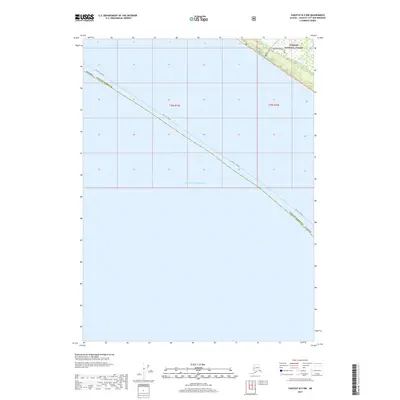
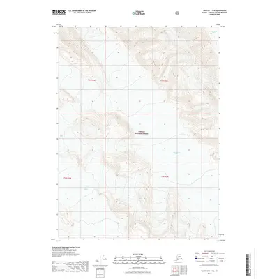
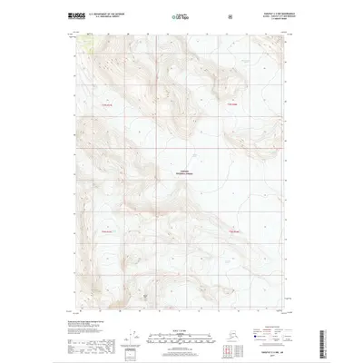
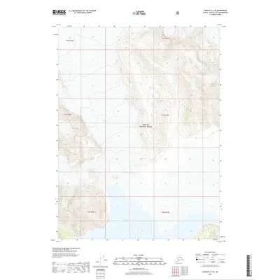
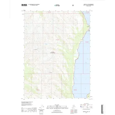
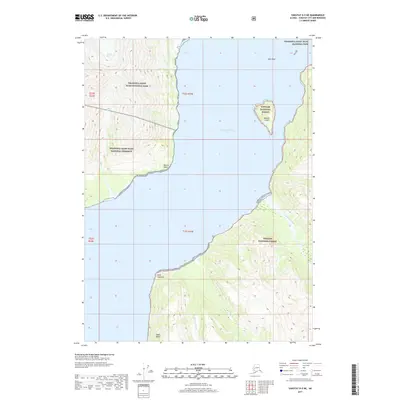
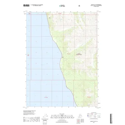
Editions of this 1959 Mt Saint Elias Map
3 editions found
Historical Maps of United States Through Time
343 maps found

1948 Bering Glacier A-4
Yakutat Borough, AK

1948 Icy Bay D-2 and D-3
Yakutat Borough, AK

1950 Bering Glacier A-3
Yakutat Borough, AK

1950 Bering Glacier
Yakutat Borough, AK

1950 Icy Bay
Yakutat Borough, AK

1951 Bering Glacier A-2
Yakutat Borough, AK

1951 Bering Glacier A-4
Yakutat Borough, AK

1951 Bering Glacier
Yakutat Borough, AK

1951 Icy Bay D-2 and D-3
Yakutat Borough, AK

1951 Icy Bay
Yakutat Borough, AK

1951 Mt Saint Elias
Yakutat Borough, AK

1959 Bering Glacier A-2
Yakutat Borough, AK

1959 Bering Glacier A-3
Yakutat Borough, AK

1959 Bering Glacier A-4
Yakutat Borough, AK

1959 Bering Glacier
Yakutat Borough, AK

1959 Icy Bay D-2 and D-3
Yakutat Borough, AK

1959 Mt Saint Elias
Yakutat Borough, AK

1959 Yakutat A-1
Yakutat Borough, AK

1959 Yakutat A-2
Yakutat Borough, AK

1959 Yakutat A-3
Yakutat Borough, AK

1959 Yakutat B-1
Yakutat Borough, AK

1959 Yakutat B-2
Yakutat Borough, AK

1959 Yakutat B-3
Yakutat Borough, AK

1959 Yakutat B-4
Yakutat Borough, AK

1959 Yakutat B-5
Yakutat Borough, AK

1959 Yakutat C-3
Yakutat Borough, AK

1959 Yakutat C-4
Yakutat Borough, AK

1959 Yakutat C-5
Yakutat Borough, AK

1959 Yakutat D-3
Yakutat Borough, AK

1959 Yakutat D-4
Yakutat Borough, AK

1959 Yakutat D-5
Yakutat Borough, AK

1961 Icy Bay
Yakutat Borough, AK

1961 Mount Fairweather D-6
Yakutat Borough, AK

1961 Mount Fairweather D-7
Yakutat Borough, AK

1961 Skagway A-7
Yakutat Borough, AK

1961 Skagway A-8
Yakutat Borough, AK

1961 Skagway B-8
Yakutat Borough, AK

1984 Bering Glacier A-4
Yakutat Borough, AK

1984 Bering Glacier A-5
Yakutat Borough, AK

1984 Bering Glacier A-6
Yakutat Borough, AK

1984 Bering Glacier A-7
Yakutat Borough, AK

1984 Bering Glacier A-8
Yakutat Borough, AK

1985 Bering Glacier A-1
Yakutat Borough, AK

1985 Bering Glacier B-1
Yakutat Borough, AK

1985 Bering Glacier B-2
Yakutat Borough, AK

1985 Bering Glacier B-3
Yakutat Borough, AK

1985 Bering Glacier B-4
Yakutat Borough, AK

1985 Bering Glacier B-5
Yakutat Borough, AK

1985 Bering Glacier B-6
Yakutat Borough, AK

1985 Bering Glacier B-7
Yakutat Borough, AK

1985 Bering Glacier C-3
Yakutat Borough, AK

1985 Bering Glacier C-4
Yakutat Borough, AK

1985 Bering Glacier C-5
Yakutat Borough, AK

1985 Bering Glacier C-6
Yakutat Borough, AK

1985 Icy Bay D-1
Yakutat Borough, AK

1985 Mount Saint Elias A-3
Yakutat Borough, AK

1985 Mount Saint Elias A-4
Yakutat Borough, AK

1985 Mount Saint Elias A-5
Yakutat Borough, AK

1985 Mount Saint Elias A-6
Yakutat Borough, AK

1985 Mount Saint Elias A-7
Yakutat Borough, AK

1985 Mount Saint Elias A-8
Yakutat Borough, AK

1985 Mount Saint Elias B-3
Yakutat Borough, AK

1985 Mount Saint Elias B-4
Yakutat Borough, AK

1985 Mount Saint Elias B-5
Yakutat Borough, AK

1985 Mount Saint Elias B-7
Yakutat Borough, AK

1985 Mount Saint Elias B-8
Yakutat Borough, AK

1985 Yakutat C-1
Yakutat Borough, AK

1985 Yakutat C-2
Yakutat Borough, AK

1985 Yakutat C-6
Yakutat Borough, AK

1985 Yakutat C-7
Yakutat Borough, AK

1985 Yakutat C-8
Yakutat Borough, AK

1985 Yakutat D-2
Yakutat Borough, AK

1985 Yakutat D-6
Yakutat Borough, AK

1985 Yakutat D-7
Yakutat Borough, AK

1985 Yakutat D-8
Yakutat Borough, AK

1987 Yakutat B-4 NW
Yakutat Borough, AK

1987 Yakutat B-5 NE
Yakutat Borough, AK

1987 Yakutat C-4 SE
Yakutat Borough, AK

1987 Yakutat C-4 SW
Yakutat Borough, AK

1987 Yakutat C-5 SE
Yakutat Borough, AK

1987 Yakutat C-5 SW
Yakutat Borough, AK

1996 Yakutat C-5
Yakutat Borough, AK

1997 Yakutat B-1
Yakutat Borough, AK

1997 Yakutat C-4
Yakutat Borough, AK

2014 Bering Glacier A-8 NE
Yakutat Borough, AK

2014 Bering Glacier A-8 OE S NW
Yakutat Borough, AK

2014 Bering Glacier A-8 SE
Yakutat Borough, AK

2014 Bering Glacier A-8 SW
Yakutat Borough, AK

2014 Bering Glacier B-6 NW
Yakutat Borough, AK

2014 Bering Glacier B-7 NE
Yakutat Borough, AK

2014 Bering Glacier C-6 SW
Yakutat Borough, AK

2016 Bering Glacier A-4 NE
Yakutat Borough, AK

2016 Bering Glacier A-4 NW
Yakutat Borough, AK

2016 Bering Glacier A-4 SE
Yakutat Borough, AK

2016 Bering Glacier A-4 SW
Yakutat Borough, AK

2016 Bering Glacier A-5 NE
Yakutat Borough, AK

2016 Bering Glacier A-5 NW
Yakutat Borough, AK

2016 Bering Glacier A-5 SE
Yakutat Borough, AK

2016 Bering Glacier A-5 SW
Yakutat Borough, AK

2016 Bering Glacier A-6 NE
Yakutat Borough, AK

2016 Bering Glacier A-6 NW
Yakutat Borough, AK

2016 Bering Glacier A-6 SE
Yakutat Borough, AK

2016 Bering Glacier A-6 SW
Yakutat Borough, AK

2016 Bering Glacier A-7 NE
Yakutat Borough, AK

2016 Bering Glacier A-7 NW
Yakutat Borough, AK

2016 Bering Glacier A-7 SE
Yakutat Borough, AK

2016 Bering Glacier A-7 SW
Yakutat Borough, AK

2016 Bering Glacier B-4 NE
Yakutat Borough, AK

2016 Bering Glacier B-4 NW
Yakutat Borough, AK

2016 Bering Glacier B-4 SE
Yakutat Borough, AK

2016 Bering Glacier B-4 SW
Yakutat Borough, AK

2016 Bering Glacier B-5 NE
Yakutat Borough, AK

2016 Bering Glacier B-5 NW
Yakutat Borough, AK

2016 Bering Glacier B-5 SE
Yakutat Borough, AK

2016 Bering Glacier B-5 SW
Yakutat Borough, AK

2016 Bering Glacier B-6 NE
Yakutat Borough, AK

2016 Bering Glacier B-6 SE
Yakutat Borough, AK

2016 Bering Glacier B-6 SW
Yakutat Borough, AK

2016 Bering Glacier B-7 SE
Yakutat Borough, AK

2016 Bering Glacier B-7 SW
Yakutat Borough, AK
2016 Bering Glacier C-4 SE
Yakutat Borough, AK
2016 Bering Glacier C-4 SW
Yakutat Borough, AK
2016 Bering Glacier C-5 SE
Yakutat Borough, AK
2016 Bering Glacier C-5 SW
Yakutat Borough, AK
2016 Bering Glacier C-6 SE
Yakutat Borough, AK

2017 Bering Glacier A-1 NE
Yakutat Borough, AK

2017 Bering Glacier A-1 NW
Yakutat Borough, AK

2017 Bering Glacier A-1 SE
Yakutat Borough, AK

2017 Bering Glacier A-1 SW
Yakutat Borough, AK

2017 Bering Glacier A-2 NE
Yakutat Borough, AK

2017 Bering Glacier A-2 NW
Yakutat Borough, AK

2017 Bering Glacier A-2 SE
Yakutat Borough, AK

2017 Bering Glacier A-2 SW
Yakutat Borough, AK

2017 Bering Glacier A-3 NE
Yakutat Borough, AK

2017 Bering Glacier A-3 NW
Yakutat Borough, AK

2017 Bering Glacier A-3 SE
Yakutat Borough, AK

2017 Bering Glacier A-3 SW
Yakutat Borough, AK

2017 Bering Glacier B-1 NE
Yakutat Borough, AK

2017 Bering Glacier B-1 NW
Yakutat Borough, AK

2017 Bering Glacier B-1 SE
Yakutat Borough, AK

2017 Bering Glacier B-1 SW
Yakutat Borough, AK

2017 Bering Glacier B-2 NE
Yakutat Borough, AK

2017 Bering Glacier B-2 NW
Yakutat Borough, AK

2017 Bering Glacier B-2 SE
Yakutat Borough, AK

2017 Bering Glacier B-2 SW
Yakutat Borough, AK

2017 Bering Glacier B-3 NE
Yakutat Borough, AK

2017 Bering Glacier B-3 NW
Yakutat Borough, AK

2017 Bering Glacier B-3 SE
Yakutat Borough, AK

2017 Bering Glacier B-3 SW
Yakutat Borough, AK
2017 Bering Glacier C-3 SE
Yakutat Borough, AK
2017 Bering Glacier C-3 SW
Yakutat Borough, AK

2017 Icy Bay D-1 NE
Yakutat Borough, AK

2017 Icy Bay D-1 NW
Yakutat Borough, AK

2017 Icy Bay D-1 SE
Yakutat Borough, AK

2017 Icy Bay D-1 SW
Yakutat Borough, AK

2017 Icy Bay D-2 NE
Yakutat Borough, AK

2017 Icy Bay D-2 NW
Yakutat Borough, AK

2017 Icy Bay D-2 SE
Yakutat Borough, AK

2017 Icy Bay D-3 NE
Yakutat Borough, AK

2017 Mount Fairweather D-5 NW
Yakutat Borough, AK

2017 Mount Fairweather D-6 NE
Yakutat Borough, AK

2017 Mount Fairweather D-6 NW
Yakutat Borough, AK

2017 Mount Fairweather D-6 SW
Yakutat Borough, AK

2017 Mount Fairweather D-7 NE
Yakutat Borough, AK

2017 Mount Saint Elias A-4 NE
Yakutat Borough, AK

2017 Mount Saint Elias A-4 NW
Yakutat Borough, AK

2017 Mount Saint Elias A-4 SE
Yakutat Borough, AK

2017 Mount Saint Elias A-4 SW
Yakutat Borough, AK

2017 Mount Saint Elias A-5 NE
Yakutat Borough, AK

2017 Mount Saint Elias A-5 NW
Yakutat Borough, AK

2017 Mount Saint Elias A-5 SE
Yakutat Borough, AK

2017 Mount Saint Elias A-5 SW
Yakutat Borough, AK

2017 Mount Saint Elias A-6 NE
Yakutat Borough, AK

2017 Mount Saint Elias A-6 NW
Yakutat Borough, AK

2017 Mount Saint Elias A-6 SE
Yakutat Borough, AK

2017 Mount Saint Elias A-6 SW
Yakutat Borough, AK

2017 Mount Saint Elias A-7 NE
Yakutat Borough, AK

2017 Mount Saint Elias A-7 NW
Yakutat Borough, AK

2017 Mount Saint Elias A-7 SE
Yakutat Borough, AK

2017 Mount Saint Elias A-7 SW
Yakutat Borough, AK

2017 Mount Saint Elias A-8 NE
Yakutat Borough, AK

2017 Mount Saint Elias A-8 NW
Yakutat Borough, AK

2017 Mount Saint Elias A-8 SE
Yakutat Borough, AK

2017 Mount Saint Elias A-8 SW
Yakutat Borough, AK

2017 Mount Saint Elias B-4 SE
Yakutat Borough, AK

2017 Mount Saint Elias B-4 SW
Yakutat Borough, AK

2017 Mount Saint Elias B-5 SE
Yakutat Borough, AK

2017 Mount Saint Elias B-5 SW
Yakutat Borough, AK

2017 Mount Saint Elias B-7 OE E SW
Yakutat Borough, AK

2017 Mount Saint Elias B-7 SE
Yakutat Borough, AK

2017 Mount Saint Elias B-7 SW
Yakutat Borough, AK

2017 Mount Saint Elias B-8 SE
Yakutat Borough, AK

2017 Mount Saint Elias B-8 SW
Yakutat Borough, AK

2017 Yakutat A-1 NE
Yakutat Borough, AK
2017 Yakutat A-1 NW
Yakutat Borough, AK

2017 Yakutat A-1 SE
Yakutat Borough, AK

2017 Yakutat A-1 SW
Yakutat Borough, AK
2017 Yakutat A-2 NE
Yakutat Borough, AK
2017 Yakutat A-2 NW
Yakutat Borough, AK

2017 Yakutat A-2 SE
Yakutat Borough, AK
2017 Yakutat A-2 SW
Yakutat Borough, AK
2017 Yakutat A-3 NE
Yakutat Borough, AK
2017 Yakutat B-1 NE
Yakutat Borough, AK
2017 Yakutat B-1 NW
Yakutat Borough, AK

2017 Yakutat B-1 SE
Yakutat Borough, AK
2017 Yakutat B-1 SW
Yakutat Borough, AK
2017 Yakutat B-2 NE
Yakutat Borough, AK
2017 Yakutat B-2 NW
Yakutat Borough, AK
2017 Yakutat B-2 SE
Yakutat Borough, AK
2017 Yakutat B-2 SW
Yakutat Borough, AK
2017 Yakutat B-3 NE
Yakutat Borough, AK
2017 Yakutat B-3 NW
Yakutat Borough, AK
2017 Yakutat B-3 SE
Yakutat Borough, AK
2017 Yakutat B-3 SW
Yakutat Borough, AK
2017 Yakutat B-4 NE
Yakutat Borough, AK
2017 Yakutat B-4 NW
Yakutat Borough, AK
2017 Yakutat B-4 SE
Yakutat Borough, AK
2017 Yakutat B-4 SW
Yakutat Borough, AK

2017 Yakutat B-5 NE
Yakutat Borough, AK
2017 Yakutat B-5 NW
Yakutat Borough, AK
2017 Yakutat C-1 NW
Yakutat Borough, AK
2017 Yakutat C-1 SE
Yakutat Borough, AK
2017 Yakutat C-1 SW
Yakutat Borough, AK
2017 Yakutat C-2 NE
Yakutat Borough, AK
2017 Yakutat C-2 NW
Yakutat Borough, AK
2017 Yakutat C-2 SE
Yakutat Borough, AK
2017 Yakutat C-2 SW
Yakutat Borough, AK
2017 Yakutat C-3 NE
Yakutat Borough, AK
2017 Yakutat C-3 NW
Yakutat Borough, AK
2017 Yakutat C-3 SE
Yakutat Borough, AK
2017 Yakutat C-3 SW
Yakutat Borough, AK
2017 Yakutat C-4 NE
Yakutat Borough, AK
2017 Yakutat C-4 NW
Yakutat Borough, AK
2017 Yakutat C-4 SE
Yakutat Borough, AK
2017 Yakutat C-4 SW
Yakutat Borough, AK
2017 Yakutat C-5 NE
Yakutat Borough, AK
2017 Yakutat C-5 SE
Yakutat Borough, AK
2017 Yakutat C-5 SW
Yakutat Borough, AK

2017 Yakutat C-6 NW
Yakutat Borough, AK

2017 Yakutat C-7 NE
Yakutat Borough, AK

2017 Yakutat C-7 NW
Yakutat Borough, AK

2017 Yakutat C-8 NE
Yakutat Borough, AK

2017 Yakutat C-8 NW
Yakutat Borough, AK
2017 Yakutat D-2 NW
Yakutat Borough, AK
2017 Yakutat D-2 SW
Yakutat Borough, AK
2017 Yakutat D-3 NE
Yakutat Borough, AK
2017 Yakutat D-3 NW
Yakutat Borough, AK
2017 Yakutat D-3 SE
Yakutat Borough, AK
2017 Yakutat D-3 SW
Yakutat Borough, AK
2017 Yakutat D-4 NE
Yakutat Borough, AK
2017 Yakutat D-4 NW
Yakutat Borough, AK
2017 Yakutat D-4 SE
Yakutat Borough, AK
2017 Yakutat D-4 SW
Yakutat Borough, AK
2017 Yakutat D-5 NE
Yakutat Borough, AK

2017 Yakutat D-5 NW
Yakutat Borough, AK
2017 Yakutat D-5 SE
Yakutat Borough, AK

2017 Yakutat D-5 SW
Yakutat Borough, AK

2017 Yakutat D-6 NE
Yakutat Borough, AK

2017 Yakutat D-6 NW
Yakutat Borough, AK

2017 Yakutat D-6 SE
Yakutat Borough, AK

2017 Yakutat D-6 SW
Yakutat Borough, AK

2017 Yakutat D-7 NE
Yakutat Borough, AK

2017 Yakutat D-7 NW
Yakutat Borough, AK

2017 Yakutat D-7 SE
Yakutat Borough, AK

2017 Yakutat D-7 SW
Yakutat Borough, AK

2017 Yakutat D-8 NE
Yakutat Borough, AK

2017 Yakutat D-8 NW
Yakutat Borough, AK

2017 Yakutat D-8 SE
Yakutat Borough, AK

2017 Yakutat D-8 SW
Yakutat Borough, AK

2018 Bering Glacier A-8 OE S NE
Yakutat Borough, AK

2018 Mount Saint Elias A-3 NW
Yakutat Borough, AK

2018 Mount Saint Elias A-3 SW
Yakutat Borough, AK

2018 Mount Saint Elias B-3 SW
Yakutat Borough, AK

2018 Yakutat A-3 NW
Yakutat Borough, AK

2021 Skagway A-7 NW
Yakutat Borough, AK

2021 Skagway A-7 SW
Yakutat Borough, AK

2021 Skagway A-8 NE
Yakutat Borough, AK

2021 Skagway A-8 NW
Yakutat Borough, AK

2021 Skagway A-8 SE
Yakutat Borough, AK

2021 Skagway A-8 SW
Yakutat Borough, AK

2021 Skagway B-8 NW
Yakutat Borough, AK

2021 Skagway B-8 OE E SW
Yakutat Borough, AK

2021 Skagway B-8 SE
Yakutat Borough, AK

2021 Skagway B-8 SW
Yakutat Borough, AK

2021 Yakutat A-1 NW
Yakutat Borough, AK

2021 Yakutat A-2 NE
Yakutat Borough, AK

2021 Yakutat A-2 NW
Yakutat Borough, AK

2021 Yakutat A-2 SW
Yakutat Borough, AK

2021 Yakutat A-3 NE
Yakutat Borough, AK

2021 Yakutat B-1 NE
Yakutat Borough, AK

2021 Yakutat B-1 NW
Yakutat Borough, AK

2021 Yakutat B-1 SW
Yakutat Borough, AK

2021 Yakutat B-2 NE
Yakutat Borough, AK

2021 Yakutat B-2 NW
Yakutat Borough, AK

2021 Yakutat B-2 SE
Yakutat Borough, AK

2021 Yakutat B-2 SW
Yakutat Borough, AK

2021 Yakutat B-3 NE
Yakutat Borough, AK

2021 Yakutat B-3 NW
Yakutat Borough, AK

2021 Yakutat B-3 SE
Yakutat Borough, AK

2021 Yakutat B-3 SW
Yakutat Borough, AK

2021 Yakutat B-4 NE
Yakutat Borough, AK

2021 Yakutat B-4 NW
Yakutat Borough, AK

2021 Yakutat B-4 SE
Yakutat Borough, AK

2021 Yakutat B-4 SW
Yakutat Borough, AK

2021 Yakutat B-5 NE
Yakutat Borough, AK

2021 Yakutat B-5 NW
Yakutat Borough, AK

2021 Yakutat C-1 NW
Yakutat Borough, AK

2021 Yakutat C-1 SE
Yakutat Borough, AK

2021 Yakutat C-1 SW
Yakutat Borough, AK

2021 Yakutat C-2 NE
Yakutat Borough, AK

2021 Yakutat C-2 NW
Yakutat Borough, AK

2021 Yakutat C-2 SE
Yakutat Borough, AK

2021 Yakutat C-2 SW
Yakutat Borough, AK

2021 Yakutat C-3 NE
Yakutat Borough, AK

2021 Yakutat C-3 NW
Yakutat Borough, AK

2021 Yakutat C-3 SE
Yakutat Borough, AK

2021 Yakutat C-3 SW
Yakutat Borough, AK

2021 Yakutat C-4 NE
Yakutat Borough, AK

2021 Yakutat C-4 NW
Yakutat Borough, AK

2021 Yakutat C-4 SE
Yakutat Borough, AK

2021 Yakutat C-4 SW
Yakutat Borough, AK

2021 Yakutat C-5 NE
Yakutat Borough, AK

2021 Yakutat C-5 SE
Yakutat Borough, AK

2021 Yakutat C-5 SW
Yakutat Borough, AK

2021 Yakutat D-2 NW
Yakutat Borough, AK

2021 Yakutat D-2 SW
Yakutat Borough, AK

2021 Yakutat D-3 NE
Yakutat Borough, AK

2021 Yakutat D-3 NW
Yakutat Borough, AK

2021 Yakutat D-3 SE
Yakutat Borough, AK

2021 Yakutat D-3 SW
Yakutat Borough, AK

2021 Yakutat D-4 NE
Yakutat Borough, AK

2021 Yakutat D-4 NW
Yakutat Borough, AK

2021 Yakutat D-4 SE
Yakutat Borough, AK

2021 Yakutat D-4 SW
Yakutat Borough, AK

2021 Yakutat D-5 NE
Yakutat Borough, AK

2021 Yakutat D-5 SE
Yakutat Borough, AK

2024 Bering Glacier C-3 SE
Yakutat Borough, AK

2024 Bering Glacier C-3 SW
Yakutat Borough, AK

2024 Bering Glacier C-4 SE
Yakutat Borough, AK

2024 Bering Glacier C-4 SW
Yakutat Borough, AK

2024 Bering Glacier C-5 SE
Yakutat Borough, AK

2024 Bering Glacier C-5 SW
Yakutat Borough, AK

2024 Bering Glacier C-6 SE
Yakutat Borough, AK