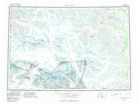
1959 Map of Mt Saint Elias
USGS Topo · Published 1983About this map
Mt St Elias and the surrounding high peaks of the Saint Elias Mountains dominate this mid-century survey, which records the immense glacial systems along the border of Alaska and Canada. The map documents the shifting ice of the Hubbard Glacier, Marvine Glacier, and the Kaskawulsh Glacier, with purple screening indicating areas of glacial advance or recession noted during revisions. The terrain spans from the coastal waters of Enchanted Bay to the interior reaches of Kluane Lake and the Alaska Highway. This area, much of it now protected within Wrangell-Saint Elias National Park and Wilderness, is characterized by massive ice fields and nunataks like Moore Nunatak. The cartography captures a landscape of extreme elevation, featuring international summits such as Mt Hubbard, Mt Alverstone, and Mt Kennedy.
Find a feature on this map
110 named features on this map. Tap any name to fly to it.
Don’t see what you’re looking for? This feature index may not catch every label — zoom into the map to look around manually.
Map Details
Editions of this 1959 Mt Saint Elias Map
3 editions found

Other maps of this area

1950 · Bering Glacier
USGS Topo · 1:250,000

1950 · Icy Bay
USGS Topo · 1:250,000

1951 · McCarthy
USGS Topo · 1:250,000

1951 · Icy Bay
USGS Topo · 1:250,000

1951 · Bering Glacier
USGS Topo · 1:250,000

1951 · Yakutat
USGS Topo · 1:250,000

1951 · Mt Saint Elias
USGS Topo · 1:250,000

1952 · Skagway
USGS Topo · 1:250,000

1959 · Yakutat D-3
USGS Topo · 1:63,360

1959 · Yakutat D-4
USGS Topo · 1:63,360