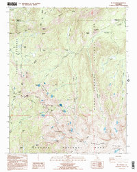
1993 Map of Mt. Silliman
USGS Topo · Published 1995About this map
The Silliman Divide and Silliman Crest dominate this high-altitude landscape where Sequoia National Park and Kings Canyon National Park converge at the Fresno and Tulare County line. This 1993 provisional survey details a terrain defined by granite summits and glacial basins, featuring prominent landmarks like Mt Silliman and Mitchell Peak. The map reveals an intricate network of alpine water bodies, including Seville Lake, Ranger Lake, and Silliman Lake, often connected by seasonal drainages like Clover Creek and Silliman Creek. Critical transit points through the high country are identified at Marvin Pass, JO Pass, and Silliman Pass, marking historical routes through the Jennie Lakes Wilderness. Notable meadows such as Horse Coral Meadow, Rowell Meadow, and Comanche Meadow indicate the small pockets of relatively level ground found within the steep drainages of Belle Canyon and the South Fork Canyon.
Find a feature on this map
52 named features on this map. Tap any name to fly to it.
Don’t see what you’re looking for? This feature index may not catch every label — zoom into the map to look around manually.
Map Details
Editions of this 1993 Mt. Silliman Map
2 editions found
Other maps of this area

1903 · Tehipite
USGS Topo · 1:125,000

1905 · Tehipite
USGS Topo · 1:125,000

1948 · Fresno
USGS Topo · 1:250,000

1952 · Tehipite Dome
USGS Topo · 1:62,500

1953 · Marion Peak
USGS Topo · 1:62,500

1955 · Fresno
USGS Topo · 1:250,000

1956 · Fresno
USGS Topo · 1:250,000

1956 · Giant Forest
USGS Topo · 1:62,500
1956 · Triple Divide Peak
USGS Topo · 1:62,500

1958 · Fresno
USGS Topo · 1:250,000