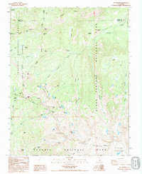
1993 Map of Mt. Silliman
USGS Topo · Published 1995About this map
Sequoia National Park and Kings Canyon National Park meet along a complex high-country boundary defined by the Silliman Crest and Silliman Divide. This 1993 provisional survey documents the convergence of protected wilderness areas, including the Jennie Lakes Wilderness and Sequoia National Forest. The landscape is characterized by a high concentration of subalpine water bodies such as Seville Lake, Ranger Lake, and Silliman Lake, which serve as the headwaters for drainages like Sugarloaf Creek and Ferguson Creek. Significant topographic landmarks like Mt Silliman, Mitchell Peak, and Kettle Peak dominate the skyline, connected by a network of high-elevation traversals including Marvin Pass, Silliman Pass, and Cahoon Gap. The map illustrates the preservation of this alpine environment, where meadows like Williams Meadow and Comanche Meadow persist within the protected parklands.
Find a feature on this map
47 named features on this map. Tap any name to fly to it.
Don’t see what you’re looking for? This feature index may not catch every label — zoom into the map to look around manually.
Map Details
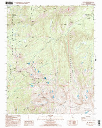
Editions of this 1993 Mt. Silliman Map
2 editions found
Other maps of this area

1903 · Tehipite
USGS Topo · 1:125,000

1905 · Tehipite
USGS Topo · 1:125,000

1948 · Fresno
USGS Topo · 1:250,000

1952 · Tehipite Dome
USGS Topo · 1:62,500

1953 · Marion Peak
USGS Topo · 1:62,500

1955 · Fresno
USGS Topo · 1:250,000

1956 · Fresno
USGS Topo · 1:250,000

1956 · Giant Forest
USGS Topo · 1:62,500
1956 · Triple Divide Peak
USGS Topo · 1:62,500

1958 · Fresno
USGS Topo · 1:250,000