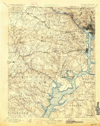
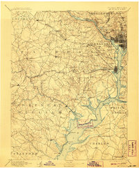
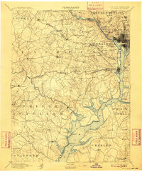
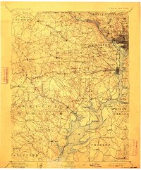
1894 Map of Mt. Vernon
USGS Topo · Published 1926About this map
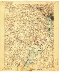
The Potomac River corridor south of Washington is captured here as it appeared in the late 19th century, revealing a landscape of strategic forts and nascent suburbs. This survey, conducted shortly after the Civil War era, illustrates the significant military footprint surrounding the capital with sites like Fort Myer, Fort Foote, and the Arlington National Cemetery. The map documents a period before the massive 20th-century expansion of the federal government, showing Alexandria as a distinct riverfront center and Fairfax as a small interior crossroads. Transportation patterns of the day are defined by the Southern R. R. and W. & O. D. R. R., while historic river crossings like Chain Bridge and the Shepherd Ferry remained vital. Farther south, the Fort Humphreys Military Reservation and Pohick Church anchor a more rural landscape of creek-fed peninsulas and landings.
Find a feature on this map
136 named features on this map. Tap any name to fly to it.
Don’t see what you’re looking for? This feature index may not catch every label — zoom into the map to look around manually.
Map Details
Editions of this 1894 Mt. Vernon Map
6 editions found

Other maps of this area

1884 · Harpers Ferry
USGS Topo · 1:125,000

1887 · Spottsylvania
USGS Topo · 1:125,000

1889 · Fredericksburg
USGS Topo · 1:125,000

1890 · Mt. Vernon
USGS Topo · 1:125,000

1891 · Harpers Ferry
USGS Topo · 1:125,000

1891 · Mt. Vernon
USGS Topo · 1:125,000

1892 · Laurel
USGS Topo · 1:62,500

1892 · Fredericksburg
USGS Topo · 1:125,000

1892 · Spottsylvania
USGS Topo · 1:125,000

1892 · Brandywine
USGS Topo · 1:62,500