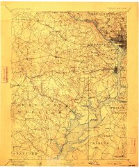
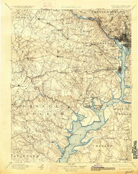
1894 Map of Mt. Vernon
USGS Topo · Published 1912About this map
The Potomac River corridor serves as the central artery for this late nineteenth-century survey, anchoring the geography of Northern Virginia, the District of Columbia, and southern Maryland. The landscape is a network of small nineteenth-century settlements and farming communities like Chantilly, Annandale, and Dunn Loring, connected by early road junctions such as Tyson Cross Roads and Bailey Cross Roads. Notable landmarks include Arlington National Cemetery and the Soldiers Home near the burgeoning urban core of Washington.
Find a feature on this map
134 named features on this map. Tap any name to fly to it.
Don’t see what you’re looking for? This feature index may not catch every label — zoom into the map to look around manually.
Map Details
Editions of this 1894 Mt. Vernon Map
6 editions found

Other maps of this area

1884 · Harpers Ferry
USGS Topo · 1:125,000

1887 · Spottsylvania
USGS Topo · 1:125,000

1889 · Fredericksburg
USGS Topo · 1:125,000

1890 · Mt. Vernon
USGS Topo · 1:125,000

1891 · Harpers Ferry
USGS Topo · 1:125,000

1891 · Mt. Vernon
USGS Topo · 1:125,000

1892 · Laurel
USGS Topo · 1:62,500

1892 · Fredericksburg
USGS Topo · 1:125,000

1892 · Spottsylvania
USGS Topo · 1:125,000

1892 · Brandywine
USGS Topo · 1:62,500