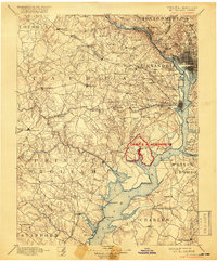
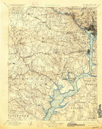
1894 Map of Mt. Vernon
USGS Topo · Published 1918About this map
Camp A. A. Humphreys appears as a prominent red overprint on this survey, highlighting the wartime military expansion along the Potomac River south of Alexandria. The map documents the intricate network of the Virginia and Maryland suburbs before the onset of modern urban sprawl, showing established rail lines like the Southern R. R. and the W. & O. D. R. R. connecting rural outposts.
Find a feature on this map
135 named features on this map. Tap any name to fly to it.
Don’t see what you’re looking for? This feature index may not catch every label — zoom into the map to look around manually.
Map Details
Editions of this 1894 Mt. Vernon Map
6 editions found

Other maps of this area

1884 · Harpers Ferry
USGS Topo · 1:125,000

1887 · Spottsylvania
USGS Topo · 1:125,000

1889 · Fredericksburg
USGS Topo · 1:125,000

1890 · Mt. Vernon
USGS Topo · 1:125,000

1891 · Harpers Ferry
USGS Topo · 1:125,000

1891 · Mt. Vernon
USGS Topo · 1:125,000

1892 · Laurel
USGS Topo · 1:62,500

1892 · Fredericksburg
USGS Topo · 1:125,000

1892 · Spottsylvania
USGS Topo · 1:125,000

1892 · Brandywine
USGS Topo · 1:62,500