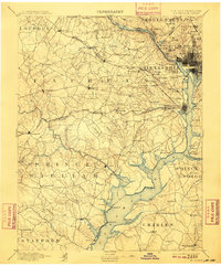
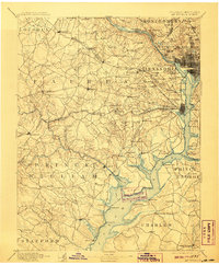
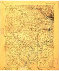
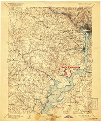
1894 Map of Mt. Vernon
USGS Topo · Published 1909About this map
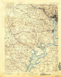
Potomac River dominates this late-19th-century landscape, serving as a geographic anchor for the burgeoning capital region and the surrounding Virginia and Maryland countryside. The map traces the historical riverfront from the urban core of Washington down to the historic estate at Mt. Vernon. This era reveals a sophisticated network of early infrastructure, including critical crossings like the Chain Bridge and the Shepherd Ferry, alongside defensive installations such as Fort Washington and Fort Myer.
Find a feature on this map
147 named features on this map. Tap any name to fly to it.
Don’t see what you’re looking for? This feature index may not catch every label — zoom into the map to look around manually.
Map Details
Editions of this 1894 Mt. Vernon Map
6 editions found

Other maps of this area

1884 · Harpers Ferry
USGS Topo · 1:125,000

1887 · Spottsylvania
USGS Topo · 1:125,000

1889 · Fredericksburg
USGS Topo · 1:125,000

1890 · Mt. Vernon
USGS Topo · 1:125,000

1891 · Harpers Ferry
USGS Topo · 1:125,000

1891 · Mt. Vernon
USGS Topo · 1:125,000

1892 · Laurel
USGS Topo · 1:62,500

1892 · Fredericksburg
USGS Topo · 1:125,000

1892 · Spottsylvania
USGS Topo · 1:125,000

1892 · Brandywine
USGS Topo · 1:62,500