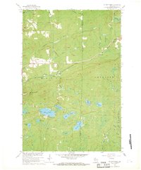
1967 Map of Mt. Whittlesey
USGS Topo · Published 1969About this map
Mt. Whittlesey rises as a prominent landmark in this northern Wisconsin landscape, surveyed in the mid-1950s and revised in the late 1960s. The area is defined by a dense network of water bodies and drainages, including the Bad River and the meandering Tyler Forks. To the west of the peak, the Berkshire Mine (Ruins) and the Mellen Lookout Tower indicate the historical industrial and forestry management activity in Ashland County.
Find a feature on this map
29 named features on this map. Tap any name to fly to it.
Don’t see what you’re looking for? This feature index may not catch every label — zoom into the map to look around manually.
Map Details
Editions of this 1967 Mt. Whittlesey Map
This is the sole edition of this map. No revisions or reprints were ever made.
Other maps of this area

1940 · Butternut
USGS Topo · 1:48,000

1940 · Upson
USGS Topo · 1:48,000

1942 · Glidden
USGS Topo · 1:48,000

1942 · Mellen
USGS Topo · 1:48,000

1943 · Upson
USGS Topo · 1:48,000

1945 · Glidden
USGS Topo · 1:48,000

1945 · Mellen
USGS Topo · 1:48,000

1947 · Butternut
USGS Topo · 1:48,000

1950 · Butternut
USGS Topo · 1:48,000

1953 · Ashland
USGS Topo · 1:250,000