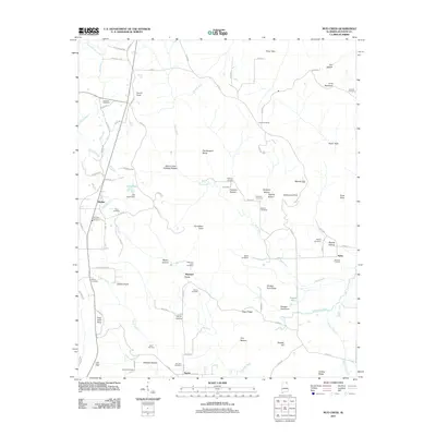
2011 Map of Mud Creek
USGS Topo · Published 2011About this map
Skyline and the smaller settlement of Tupelo anchor this 2011 survey of northeastern Alabama, where the Cumberland Plateau begins to transition into complex valley systems. The landscape is heavily defined by family-named hollows and ridges, such as Harris Hollow, Houston Hollow, and Dudley Ridge. This area shows a high density of rural burial sites, including the Maynard Cove Cemetery, Dolberry Cemetery, and Sharp Cemetery, many of which sit on high ground above the winding path of Mud Creek. Notable physical landmarks like The Buzzard Roost, Piney Point, and Chicken Foot Ridge characterize the varied terrain, while local industry is represented by a Gravel Pit near Skyline. The map captures a moment of modern rural infrastructure, tracing numerous county roads that link these isolated gaps and coves.
Find a feature on this map
97 named features on this map. Tap any name to fly to it.
Don’t see what you’re looking for? This feature index may not catch every label — zoom into the map to look around manually.
Map Details
Editions of this 2011 Mud Creek Map
This is the sole edition of this map. No revisions or reprints were ever made.
Other maps of this area

1886 · Stevenson
USGS Topo · 1:125,000

1888 · Scottsboro
USGS Topo · 1:125,000

1892 · Scottsboro
USGS Topo · 1:125,000

1892 · Stevenson
USGS Topo · 1:125,000

1895 · Stevenson
USGS Topo · 1:125,000

1936 · Scottsboro
USGS Topo · 1:24,000

1936 · Wannville
USGS Topo · 1:24,000

1936 · Mud Creek
USGS Topo · 1:24,000

1936 · Hytop
USGS Topo · 1:24,000

1936 · Princeton
USGS Topo · 1:24,000