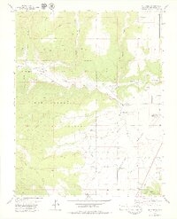
1979 Map of Mud Creek
USGS Topo · Published 1979About this map
McElmo Creek carves a significant path through the northern landscape of this 1970s survey, marking a transition between the rugged canyonlands and the irrigated agricultural lands of the Montezuma Valley. The map highlights a complex relationship between natural water features like Mud Creek and the man-made infrastructure of the Duncan Ditch and Highline Ditch, which supported the region's farming and ranching. Large portions of the territory are designated as the Ute Mountain Indian Reservation, illustrating the intersection of tribal lands and public history.
Find a feature on this map
23 named features on this map. Tap any name to fly to it.
Don’t see what you’re looking for? This feature index may not catch every label — zoom into the map to look around manually.
Map Details
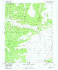
Editions of this 1979 Mud Creek Map
2 editions found
Other maps of this area

1956 · Cortez
USGS Topo · 1:250,000

1957 · Moqui SE
USGS Topo · 1:24,000

1958 · Cortez SW
USGS Topo · 1:24,000

1958 · Sentinel Peak NE
USGS Topo · 1:24,000

1958 · Cortez
USGS Topo · 1:250,000

1959 · Cortez
USGS Topo · 1:250,000

1962 · Cortez
USGS Topo · 1:250,000

1965 · Woods Canyon
USGS Topo · 1:24,000

1965 · Cortez
USGS Topo · 1:24,000

1965 · Dolores West
USGS Topo · 1:24,000