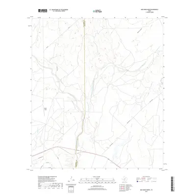
2019 Map of Mud Creek North
USGS Topo · Published 2019About this map
Bertani Ranch Airport sits as a central landmark in this portion of the Texas borderlands, where the landscape is defined by a dense network of seasonal drainage patterns. The boundary between Val Verde County and Kinney County bisects the terrain, illustrating the jurisdictional divide in this rural ranching region. Water, though often intermittent, has carved significant features into the earth, including the prominent Sycamore Creek and its various tributaries such as the East Fork Sycamore Creek and E Fork Sycamore Cr.
Find a feature on this map
16 named features on this map. Tap any name to fly to it.
Don’t see what you’re looking for? This feature index may not catch every label — zoom into the map to look around manually.
Map Details
Editions of this 2019 Mud Creek North Map
This is the sole edition of this map. No revisions or reprints were ever made.
Other maps of this area

1941 · Standart
USGS Topo · 1:62,500

1943 · Standart
USGS Topo · 1:62,500

1943 · Del Rio
USGS Topo · 1:62,500

1944 · Flat Rock
USGS Topo · 1:62,500

1944 · Devils Lake
USGS Topo · 1:62,500

1958 · Del Rio
USGS Topo · 1:250,000

1964 · Del Rio
USGS Topo · 1:250,000

1972 · Rough Canyon SE
USGS Topo · 1:24,000

1972 · Del Rio SE
USGS Topo · 1:24,000
1972 · Del Rio NE
USGS Topo · 1:24,000