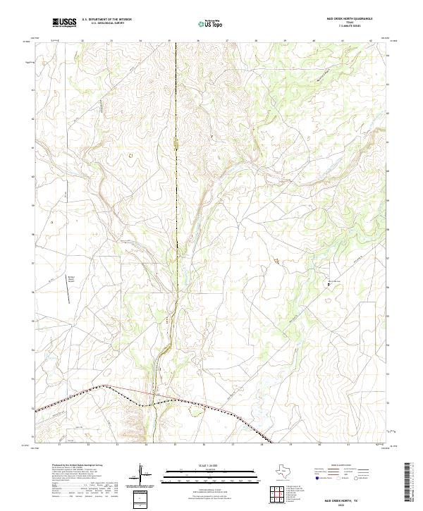
2022 Map of Mud Creek North
USGS Topo · Published 2022About this map
Sycamore Creek and the East Fork Sycamore Creek dominate this landscape on the border of Val Verde and Kinney counties. The terrain is defined by a network of drainage systems, including Maurice Canyon and Javelina Draw, which feed into the primary creek beds. Human activity in this rural stretch of South Texas is marked by aviation and ranching infrastructure, notably the Bertani Ranch Airport in the western portion of the quadrangle. Local transportation follows the contours of the land via routes such as FM 2523 and Mud Creek Rd. Genealogists and local historians will find the Mud Creek Cem located near the banks of Mud Cr, a small but significant landmark in a region otherwise characterized by isolated ranch roads like Rancho Del Rio and Buck Trl.
Find a feature on this map
19 named features on this map. Tap any name to fly to it.
Don’t see what you’re looking for? This feature index may not catch every label — zoom into the map to look around manually.
Map Details
Editions of this 2022 Mud Creek North Map
This is the sole edition of this map. No revisions or reprints were ever made.
Other maps of this area

1941 · Standart
USGS Topo · 1:62,500

1943 · Standart
USGS Topo · 1:62,500

1943 · Del Rio
USGS Topo · 1:62,500

1944 · Flat Rock
USGS Topo · 1:62,500

1944 · Devils Lake
USGS Topo · 1:62,500

1958 · Del Rio
USGS Topo · 1:250,000

1964 · Del Rio
USGS Topo · 1:250,000

1972 · Rough Canyon SE
USGS Topo · 1:24,000

1972 · Del Rio SE
USGS Topo · 1:24,000
1972 · Del Rio NE
USGS Topo · 1:24,000