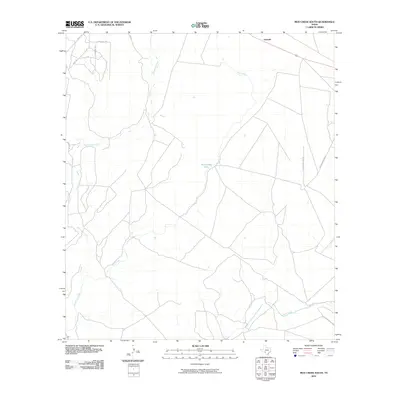
2010 Map of Mud Creek South
USGS Topo · Published 2010About this map
Amanda anchors the northeastern corner of this West Texas landscape, where a sparse network of roads and trails navigates a terrain defined by intermittent waterways. The hydrology of the area is dominated by the winding course of Mud Creek, which flows south toward its confluence with Pinto Creek in the southeastern quadrant. This 2010 survey highlights a remote rangeland character, evidenced by the reliance on cattle-related landmarks such as the Mud Creek Tank.
Find a feature on this map
13 named features on this map. Tap any name to fly to it.
Don’t see what you’re looking for? This feature index may not catch every label — zoom into the map to look around manually.
Map Details
Editions of this 2010 Mud Creek South Map
This is the sole edition of this map. No revisions or reprints were ever made.
Other maps of this area

1941 · Standart
USGS Topo · 1:62,500

1941 · Tequesquite Creek
USGS Topo · 1:62,500

1943 · Standart
USGS Topo · 1:62,500

1943 · Del Rio
USGS Topo · 1:62,500

1944 · Sycamore Ranch
USGS Topo · 1:62,500

1944 · Tequesquite Creek
USGS Topo · 1:62,500

1958 · Del Rio
USGS Topo · 1:250,000

1964 · Del Rio
USGS Topo · 1:250,000

1972 · Del Rio SE
USGS Topo · 1:24,000
1972 · Del Rio NE
USGS Topo · 1:24,000