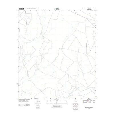
2012 Map of Mud Creek South
USGS Topo · Published 2012About this map
Amanda occupies a small corner of this Kinney County landscape, where the vast drainage systems of the West Texas brush country define the geography. The map illustrates a network of ephemeral waterways, most notably the winding course of Mud Cr and its associated Mud Cr Tank, which serve as vital water resources in this arid environment. These creek beds, along with Sycamore Cr and Pinto Cr, create a complex natural drainage pattern that dictates the placement of local infrastructure. To the northwest, a cluster of named routes such as Fury Creek Trl, Javalina Trl, and Quail Trl suggests localized development or ranch access roads, while Hadley Wardlaw Rd provides a primary north-south artery through the territory.
Find a feature on this map
13 named features on this map. Tap any name to fly to it.
Don’t see what you’re looking for? This feature index may not catch every label — zoom into the map to look around manually.
Map Details
Editions of this 2012 Mud Creek South Map
This is the sole edition of this map. No revisions or reprints were ever made.
Other maps of this area

1941 · Standart
USGS Topo · 1:62,500

1941 · Tequesquite Creek
USGS Topo · 1:62,500

1943 · Standart
USGS Topo · 1:62,500

1943 · Del Rio
USGS Topo · 1:62,500

1944 · Sycamore Ranch
USGS Topo · 1:62,500

1944 · Tequesquite Creek
USGS Topo · 1:62,500

1958 · Del Rio
USGS Topo · 1:250,000

1964 · Del Rio
USGS Topo · 1:250,000

1972 · Del Rio SE
USGS Topo · 1:24,000
1972 · Del Rio NE
USGS Topo · 1:24,000