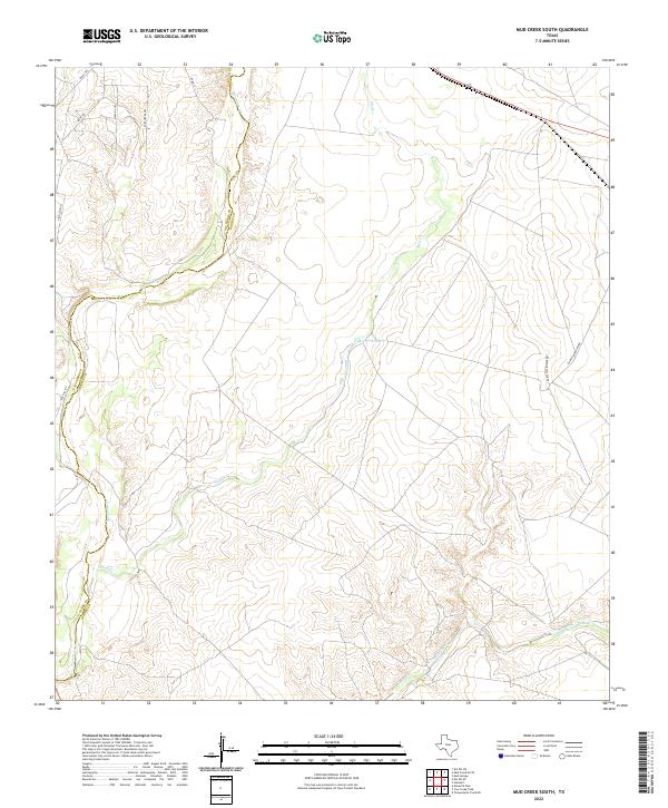
2022 Map of Mud Creek South
USGS Topo · Published 2022About this map
Sycamore Cr and Mud Cr define the drainage patterns of this Southwest Texas landscape, marking the rugged transition across the Val Verde and Kinney County line. The terrain is crisscrossed by a network of ranch roads and specialized paths such as Javalina Trl, Fury Creek Trl, and Buck Trl, reflecting the area's ongoing use for livestock and land management. Water resources are localized at features like the Mud Cr Tank, which provides a vital catchment point in this arid environment. To the south, Pinto Creek meanders through the topography, while major arteries like Hadley Ward Law Rd and Route 90 connect this remote borderland to the wider region. The map illustrates a sparse settlement pattern dominated by large landholdings and natural creek beds.
Find a feature on this map
15 named features on this map. Tap any name to fly to it.
Don’t see what you’re looking for? This feature index may not catch every label — zoom into the map to look around manually.
Map Details
Editions of this 2022 Mud Creek South Map
This is the sole edition of this map. No revisions or reprints were ever made.
Other maps of this area

1941 · Standart
USGS Topo · 1:62,500

1941 · Tequesquite Creek
USGS Topo · 1:62,500

1943 · Standart
USGS Topo · 1:62,500

1943 · Del Rio
USGS Topo · 1:62,500

1944 · Sycamore Ranch
USGS Topo · 1:62,500

1944 · Tequesquite Creek
USGS Topo · 1:62,500

1958 · Del Rio
USGS Topo · 1:250,000

1964 · Del Rio
USGS Topo · 1:250,000

1972 · Del Rio SE
USGS Topo · 1:24,000
1972 · Del Rio NE
USGS Topo · 1:24,000