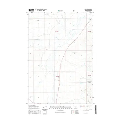
2014 Map of Mud Lake
USGS Topo · Published 2014About this map
Wisdom serves as the focal point of this western Montana landscape, situated near the headwaters of the Big Hole River. The terrain is defined by a complex network of waterways, including the meandering N Fork Big Hole River and Steel Creek, which flow through the broad valley before entering the surrounding timberlands. To the east, the boundary of the Beaverhead National Forest marks a transition from the open valley floor toward the foothills, where the namesake Mud Lake lies tucked against the forest edge.
Find a feature on this map
22 named features on this map. Tap any name to fly to it.
Don’t see what you’re looking for? This feature index may not catch every label — zoom into the map to look around manually.
Map Details
Editions of this 2014 Mud Lake Map
This is the sole edition of this map. No revisions or reprints were ever made.
Other maps of this area

1955 · Dillon
USGS Topo · 1:250,000

1957 · Dillon
USGS Topo · 1:250,000

1958 · Dillon
USGS Topo · 1:250,000

1962 · Dillon
USGS Topo · 1:250,000

1962 · Wisdom
USGS Topo · 1:24,000

1962 · Mud Lake
USGS Topo · 1:24,000

1962 · Pine Hill
USGS Topo · 1:24,000

1962 · Stewart Mountain
USGS Topo · 1:24,000

1962 · Pintlar Lake
USGS Topo · 1:24,000

1962 · Proposal Rock
USGS Topo · 1:24,000