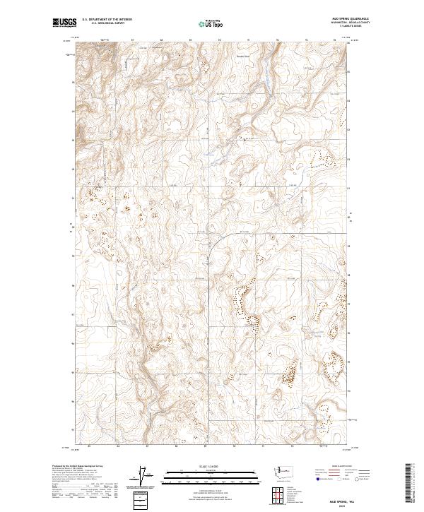
2023 Map of Mud Spring
USGS Topo · Published 2023About this map
Mud Spring and the surrounding plateau of Douglas County define this high-desert landscape, where the terrain is marked by deep glacial depressions and intermittent water sources. The area is characterized by significant natural depressions like Boulder Park in the north and the winding course of West Foster Creek. A network of rural roads, including Dutch Henry Draw Rd and Mc Neil Canyon Rd NW, trace the section lines and natural draws that cut through the undulating surface. Historical water sources such as Marion Hill Spring and Willow Spring reflect the critical importance of localized hydrology for ranching and land use in this part of Washington. The map also captures several prominent drainage features, notably Long Draw and Wolf Draw, illustrating how water has historically shaped the local topography and settlement patterns.
Find a feature on this map
31 named features on this map. Tap any name to fly to it.
Don’t see what you’re looking for? This feature index may not catch every label — zoom into the map to look around manually.
Map Details
Editions of this 2023 Mud Spring Map
This is the sole edition of this map. No revisions or reprints were ever made.
Other maps of this area

1953 · Ritzville
USGS Topo · 1:250,000

1959 · Ritzville
USGS Topo · 1:250,000

1965 · Ritzville
USGS Topo · 1:250,000

1965 · Jameson Lake West
USGS Topo · 1:24,000

1968 · Withrow
USGS Topo · 1:24,000

1968 · Lamoine
USGS Topo · 1:24,000

1968 · Chelan Falls
USGS Topo · 1:24,000

1968 · Chief Joseph Dam
USGS Topo · 1:24,000

1968 · Wells Dam
USGS Topo · 1:24,000
1968 · Azwell
USGS Topo · 1:24,000