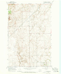
1968 Map of Mud Spring
USGS Topo · Published 1971About this map
Mud Spring Community Club sits at the heart of this high plateau in Douglas County, representing a focal point for the local agricultural community during the late 1960s. The landscape is defined by the headwaters of West Foster Creek and a series of rugged topographical depressions including Dutch Henry Draw, Wolf Draw, and Long Draw. This survey illustrates the vital importance of groundwater in the region, marking numerous natural water sources such as Marion Hill Spring, Willow Spring, and the namesake Mud Spring.
Find a feature on this map
16 named features on this map. Tap any name to fly to it.
Don’t see what you’re looking for? This feature index may not catch every label — zoom into the map to look around manually.
Map Details
Editions of this 1968 Mud Spring Map
This is the sole edition of this map. No revisions or reprints were ever made.
Other maps of this area

1953 · Ritzville
USGS Topo · 1:250,000

1959 · Ritzville
USGS Topo · 1:250,000

1965 · Ritzville
USGS Topo · 1:250,000

1965 · Jameson Lake West
USGS Topo · 1:24,000

1968 · Withrow
USGS Topo · 1:24,000

1968 · Lamoine
USGS Topo · 1:24,000

1968 · Chelan Falls
USGS Topo · 1:24,000

1968 · Chief Joseph Dam
USGS Topo · 1:24,000

1968 · Wells Dam
USGS Topo · 1:24,000
1968 · Azwell
USGS Topo · 1:24,000