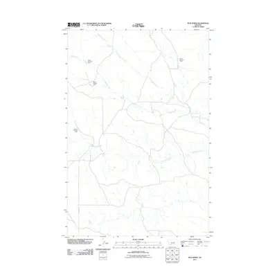
2011 Map of Mud Spring
USGS Topo · Published 2011About this map
Maginnis Creek and its northern branch, North Maginnis Creek, define the drainage patterns across this part of Petroleum County. The landscape is characterized by its agricultural and ranching infrastructure, evidenced by several water management sites such as Bethel Number 1 Dam, Bethel Number 7 Dam, and Frazer Number 1 Dam. These features, alongside Goffena Number 2 Dam, illustrate a reliance on collected water resources in a region where Mud Springs Creek flows toward the south. The area remains largely open and rural, connected by a network of local routes including the primary County Rd, reflecting the remote ranching character of central Montana in the early 21st century.
Find a feature on this map
8 named features on this map. Tap any name to fly to it.
Don’t see what you’re looking for? This feature index may not catch every label — zoom into the map to look around manually.
Map Details
Editions of this 2011 Mud Spring Map
This is the sole edition of this map. No revisions or reprints were ever made.
Other maps of this area

1954 · Forsyth
USGS Topo · 1:250,000

1954 · Roundup
USGS Topo · 1:250,000

1957 · Forsyth
USGS Topo · 1:250,000

1958 · Roundup
USGS Topo · 1:250,000

1958 · Forsyth
USGS Topo · 1:250,000

1962 · Mosby
USGS Topo · 1:24,000

1962 · Maxwell Ranch
USGS Topo · 1:24,000

1962 · Melstone NW
USGS Topo · 1:24,000

1963 · Kelley
USGS Topo · 1:24,000

1963 · Petrolia Lake
USGS Topo · 1:24,000