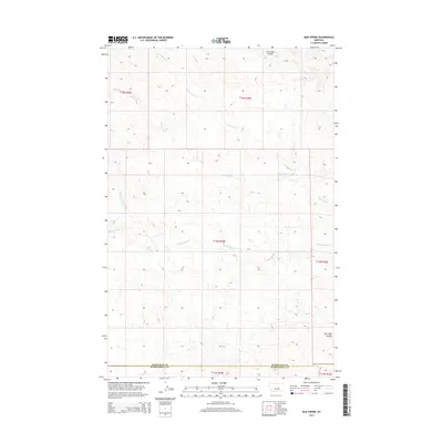
2014 Map of Mud Spring
USGS Topo · Published 2014About this map
Mud Spring and the surrounding drainage network of Mud Springs Cr define this Central Montana landscape along the border of Petroleum and Musselshell Counties. The terrain is deeply etched by a system of coulees and seasonal creeks, reflecting the arid environment of the High Plains where water sources were critical for ranching and travel. Significant landmarks like Circle Bar Spring and the Circle Bar Coulee indicate the local history of land use and the importance of named springs in an otherwise dry expanse. The northern portion of the map is dominated by the branches of N Maginnis Cr and Maginnis Cr, while the southern reaches descend toward Salt Sage Coulee. This survey captures the rural character of the region, showing the township and range lines that organized settlement across this section of the state.
Find a feature on this map
14 named features on this map. Tap any name to fly to it.
Don’t see what you’re looking for? This feature index may not catch every label — zoom into the map to look around manually.
Map Details
Editions of this 2014 Mud Spring Map
This is the sole edition of this map. No revisions or reprints were ever made.
Other maps of this area

1954 · Forsyth
USGS Topo · 1:250,000

1954 · Roundup
USGS Topo · 1:250,000

1957 · Forsyth
USGS Topo · 1:250,000

1958 · Roundup
USGS Topo · 1:250,000

1958 · Forsyth
USGS Topo · 1:250,000

1962 · Mosby
USGS Topo · 1:24,000

1962 · Maxwell Ranch
USGS Topo · 1:24,000

1962 · Melstone NW
USGS Topo · 1:24,000

1963 · Kelley
USGS Topo · 1:24,000

1963 · Petrolia Lake
USGS Topo · 1:24,000