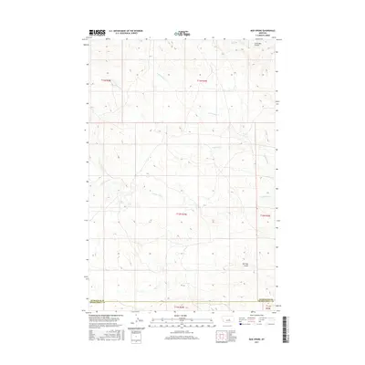
2017 Map of Mud Spring
USGS Topo · Published 2017About this map
Mud Spring and the surrounding drainage of Mud Springs Cr anchor this high-plains landscape in central Montana. This 2017 topographic survey reveals a sparsely developed region where water sources and topographic depressions, or coulees, serve as the primary landmarks for navigation and land management. The presence of Circle Bar Spring and the nearby Circle Bar Coulee indicates a history of ranching or livestock movement through this corner of Petroleum and Musselshell Counties. The terrain is further defined by seasonal watercourses like Maginnis Cr and N Maginnis Cr, while Salt Sage Coulee cuts through the southern reaches of the map. This study primarily tracks the intricate contour lines and public land survey boundaries that define the geography of this remote interior stretch.
Find a feature on this map
14 named features on this map. Tap any name to fly to it.
Don’t see what you’re looking for? This feature index may not catch every label — zoom into the map to look around manually.
Map Details
Editions of this 2017 Mud Spring Map
This is the sole edition of this map. No revisions or reprints were ever made.
Other maps of this area

1954 · Forsyth
USGS Topo · 1:250,000

1954 · Roundup
USGS Topo · 1:250,000

1957 · Forsyth
USGS Topo · 1:250,000

1958 · Roundup
USGS Topo · 1:250,000

1958 · Forsyth
USGS Topo · 1:250,000

1962 · Mosby
USGS Topo · 1:24,000

1962 · Maxwell Ranch
USGS Topo · 1:24,000

1962 · Melstone NW
USGS Topo · 1:24,000

1963 · Kelley
USGS Topo · 1:24,000

1963 · Petrolia Lake
USGS Topo · 1:24,000