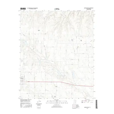
2016 Map of Muenster East
USGS Topo · Published 2016About this map
Muenster serves as the western anchor of this Cooke County landscape, where the town's grid sits just north of the major highway and rail corridor. To the southeast, the small community of Myra is positioned near the junction of FM 1198 and the railroad. The terrain is defined by a dense network of drainage systems, most notably Dry Elm Creek and its many tributaries like Squirrel Creek and Brushy Elm Creek, which carve through the local topography. For those tracing family histories in the area, the map preserves the locations of Hayes Cemetery and Van Slyke Cemetery. Distinctive landforms such as Wolf Ridge, Opossum Hollow, and Black Hollow punctuate the rural sections, while Dreamland Airport stands out as a unique modern landmark amidst the predominantly agricultural and ranching parcels connected by a web of county roads.
Find a feature on this map
55 named features on this map. Tap any name to fly to it.
Don’t see what you’re looking for? This feature index may not catch every label — zoom into the map to look around manually.
Map Details
Editions of this 2016 Muenster East Map
This is the sole edition of this map. No revisions or reprints were ever made.
Other maps of this area

1902 · Gainesville
USGS Topo · 1:125,000

1943 · Gainesville
USGS Topo · 1:125,000

1954 · Sherman
USGS Topo · 1:250,000

1958 · Sherman
USGS Topo · 1:250,000

1960 · Gainesville South
USGS Topo · 1:24,000

1960 · Gainesville North
USGS Topo · 1:24,000

1961 · Muenster West
USGS Topo · 1:24,000

1961 · Freemound
USGS Topo · 1:24,000

1961 · Hood
USGS Topo · 1:24,000

1961 · Muenster East
USGS Topo · 1:24,000