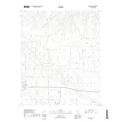
2019 Map of Muenster East
USGS Topo · Published 2019About this map
Muenster and Myra anchor the southwestern portion of this North Texas survey, where the rolling plains meet the drainages of the Trinity River watershed. The terrain is defined by a series of prominent ridges and drainages, notably Wolf Ridge and the dissecting valleys of Opossum Hollow and Black Hollow. A network of county roads provides access to rural homesteads and agricultural lands, crossing numerous watercourses such as Dry Elm Creek, Squirrel Cr, and Tonkawa Cr. The landscape reflects a mix of traditional ranching and aviation history, evidenced by the presence of the Dreamland Airport near Myra. Local heritage is preserved in quiet sites like Hayes Cem and Van Syke Cem, which serve as markers of the area's early settlement. This study of Cooke County captures a rural environment where infrastructure like FM 2739 and FM 1198 ties together scattered residences and the vital natural waterways that define the local geography.
Find a feature on this map
59 named features on this map. Tap any name to fly to it.
Don’t see what you’re looking for? This feature index may not catch every label — zoom into the map to look around manually.
Map Details
Editions of this 2019 Muenster East Map
This is the sole edition of this map. No revisions or reprints were ever made.
Other maps of this area

1902 · Gainesville
USGS Topo · 1:125,000

1943 · Gainesville
USGS Topo · 1:125,000

1954 · Sherman
USGS Topo · 1:250,000

1958 · Sherman
USGS Topo · 1:250,000

1960 · Gainesville South
USGS Topo · 1:24,000

1960 · Gainesville North
USGS Topo · 1:24,000

1961 · Muenster West
USGS Topo · 1:24,000

1961 · Freemound
USGS Topo · 1:24,000

1961 · Hood
USGS Topo · 1:24,000

1961 · Muenster East
USGS Topo · 1:24,000