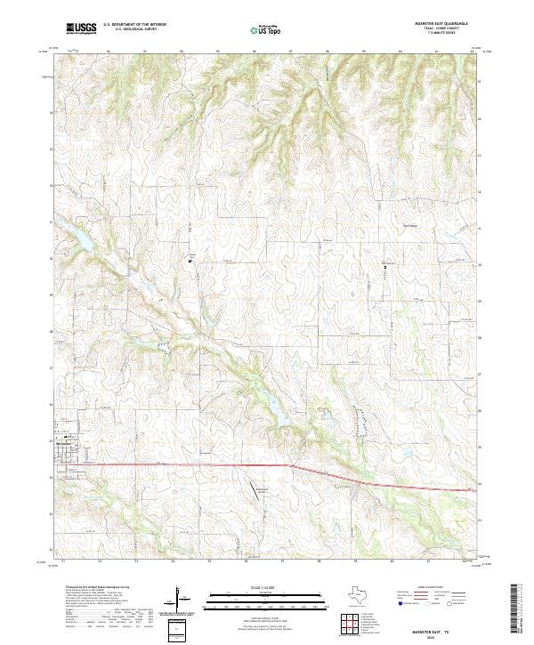
2022 Map of Muenster East
USGS Topo · Published 2022About this map
The community of Muenster serves as the focal point for this survey of rural Cooke County, revealing a landscape defined by its network of creeks and elevated ridges. The eastern edge of town is marked by Sacred Heart Cem, while the surrounding countryside is characterized by drainage systems like Dry Elm Cr and Squirrel Cr that cut through the terrain. To the north, Wolf Ridge and Opossum Hollow provide topographic variation, while the Dreamland Airport near FM 1199 highlights the local infrastructure.
Find a feature on this map
58 named features on this map. Tap any name to fly to it.
Don’t see what you’re looking for? This feature index may not catch every label — zoom into the map to look around manually.
Map Details
Editions of this 2022 Muenster East Map
This is the sole edition of this map. No revisions or reprints were ever made.
Other maps of this area

1902 · Gainesville
USGS Topo · 1:125,000

1943 · Gainesville
USGS Topo · 1:125,000

1954 · Sherman
USGS Topo · 1:250,000

1958 · Sherman
USGS Topo · 1:250,000

1960 · Gainesville South
USGS Topo · 1:24,000

1960 · Gainesville North
USGS Topo · 1:24,000

1961 · Muenster West
USGS Topo · 1:24,000

1961 · Freemound
USGS Topo · 1:24,000

1961 · Hood
USGS Topo · 1:24,000

1961 · Muenster East
USGS Topo · 1:24,000