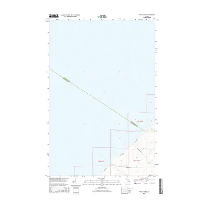
2014 Map of Muggun Creek
USGS Topo · Published 2014About this map
Lake Superior dominates this coastal survey, where the rugged shoreline of the Keweenaw Peninsula meets the water. The map documents the northernmost reaches of Michigan, tracing the diagonal boundary line between Keweenaw County and Houghton County. Small waterways such as Muggun Creek, Brewery Creek, and Gardeners Creek drain toward the lake, carving through the terrain near the coast. Infrastructure is sparse but intentional, centered on road networks like Lakeshore Drive and Fisherman Road that follow the natural contours of the land. The inclusion of Calumet Waterworks Road points to the utility and development needs of this copper country region, serving as a reminder of the historical industrial importance of the nearby townships even in this more modern cartographic record.
Find a feature on this map
12 named features on this map. Tap any name to fly to it.
Don’t see what you’re looking for? This feature index may not catch every label — zoom into the map to look around manually.
Map Details
Editions of this 2014 Muggun Creek Map
This is the sole edition of this map. No revisions or reprints were ever made.
Other maps of this area

1915 · Houghton
USGS Topo · 1:62,500

1941 · Ahmeek
USGS Topo · 1:31,680

1946 · Hancock
USGS Topo · 1:24,000

1946 · Muggun Creek
USGS Topo · 1:24,000

1946 · Ahmeek
USGS Topo · 1:24,000

1946 · Laurium
USGS Topo · 1:24,000

1947 · Ahmeek
USGS Topo · 1:24,000
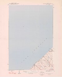
1948 · Muggun Creek
USGS Topo · 1:24,000

1948 · Laurium
USGS Topo · 1:24,000

1948 · Hancock
USGS Topo · 1:24,000