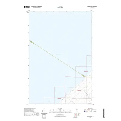
2019 Map of Muggun Creek
USGS Topo · Published 2019About this map
Lake Superior dominates this portion of Michigan’s Keweenaw Peninsula, where the coastline transitions from the open water to the wooded bluffs of the northern Copper Country. The rugged shore is marked by small drainage points like Muggun Cr and Brewery Cr, which carve through the elevations near the boundary between Keweenaw and Houghton Counties. While much of the interior remains undeveloped forest, a network of local thoroughfares such as Calumet Waterworks Rd and Fisherman Rd provides access to the coastal margins. The map illustrates a landscape shaped by its proximity to the lake, with residential and utility routes like N Lakeshore Dr tracing the contours of the land just above the water's edge, reflecting the enduring local reliance on the lakefront for both industry and recreation in the early twenty-first century.
Find a feature on this map
13 named features on this map. Tap any name to fly to it.
Don’t see what you’re looking for? This feature index may not catch every label — zoom into the map to look around manually.
Map Details
Editions of this 2019 Muggun Creek Map
This is the sole edition of this map. No revisions or reprints were ever made.
Other maps of this area

1915 · Houghton
USGS Topo · 1:62,500

1941 · Ahmeek
USGS Topo · 1:31,680

1946 · Hancock
USGS Topo · 1:24,000

1946 · Muggun Creek
USGS Topo · 1:24,000

1946 · Ahmeek
USGS Topo · 1:24,000

1946 · Laurium
USGS Topo · 1:24,000

1947 · Ahmeek
USGS Topo · 1:24,000
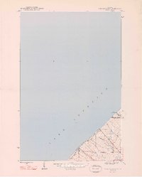
1948 · Muggun Creek
USGS Topo · 1:24,000

1948 · Laurium
USGS Topo · 1:24,000

1948 · Hancock
USGS Topo · 1:24,000