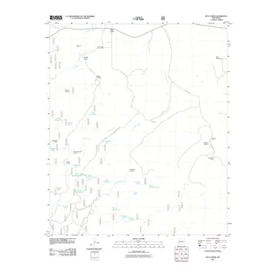
2011 Map of Mule Creek
USGS Topo · Published 2011About this map
Mule Creek serves as the central landmark of this high-elevation landscape in Grant County, where a network of cattle tanks and remote ranching outposts defines the human presence. The map documents several established ranching operations, including the Larremore Ranch, Harkey Taylor Ranch Ranch, and Y Six Ranch, scattered across a terrain carved by canyons and draws. Notable topographical features such as Sunflower Mesa and the Mule Mountains overlook a complex drainage system fed by Tennessee Creek and Pine Cienega Creek. The prevalence of named water sources like Mule Spring, Dripping Spring, and numerous livestock tanks—including the Hardluck Tank and Ball Park Tank—illustrates the critical importance of water management in this arid environment. Transportation is limited to a few arterial routes like Bays RD and Brushy Mountain RD, highlighting the isolation of these high-desert settlements.
Find a feature on this map
43 named features on this map. Tap any name to fly to it.
Don’t see what you’re looking for? This feature index may not catch every label — zoom into the map to look around manually.
Map Details
Editions of this 2011 Mule Creek Map
This is the sole edition of this map. No revisions or reprints were ever made.
Other maps of this area

1910 · Mogollon
USGS Topo · 1:125,000

1912 · Mogollon
USGS Topo · 1:125,000

1913 · Morenci
USGS Topo · 1:125,000

1915 · Morenci
USGS Topo · 1:125,000

1954 · Silver City
USGS Topo · 1:250,000

1954 · Clifton
USGS Topo · 1:250,000

1957 · Clifton
USGS Topo · 1:250,000

1958 · Silver City
USGS Topo · 1:250,000

1958 · Clifton
USGS Topo · 1:250,000

1959 · Steeple Rock
USGS Topo · 1:62,500